 |
| Photo: Jake |
On the weekend of April 21st, myself and a bunch of friends took a trip to Parent, QC and Casey, QC to visit what is left of the cold war military facilities; the auxiliary 8000ft concrete airstrip at Casey, and the former RCAF Station Parent. Here is an overview of how that all went, with maps and pictures to tie it all together for you :)
Route - April 21st, 2012
(According to Google Maps, that's ~450Km)
Setting the stage, on Saturday morning we were running late (doing the last of the packing, and "being a princess" I was told), it had been raining, and the roads were still wet. I had installed new wiper blades on the truck (that TW was driving) and evidently one of them wasn't secure enough - so it flew off while being used. Luckily, I had a spare... this was really foreshadowing for how the rest of the weekend would go. We pulled off the road, fixed the blade, taped it on with duct tape (invaluable for this whole trip), and met the rest of the party by the giant satellite dish at Tunney's Pasture.
We set off, already almost 2 hours late, for Mont Laurier, where we'd meet up with the last member of our crew (JA) who was meeting us at the Tim's, coming from Montreal to the East along the 117. Mont Laurier makes a good spot to meet up with others, as it's somewhat of the last bastion of civilization before the gas prices get crazy, and the pavement stops.
While I had done significant repairs and tune-ups to the Iltis, including rebuilding the carburetor, switching it back to a waterproof ignition system, etc.. it seems the frayed wire to the ignition coil, that was holding on by a thread, decided to give up - so with some ingenuity, CE suggested we use a hose clamp and some hose to fashion a makeshift connector to join my new replacement cable that I had handy, to the old wiring harness. What do you know, it worked!
 |
On the left, an Iltis compatible (originally Unimog 404) ignition coil cable and connector.
On the right; a piece of crap.
Photo: Tannis
|
Off we went again, now even later that before. JA was in 3G range of Mont Laurier, so we messaged him and let him know he could cool his heels for a while - we were on our way, but at least two to three hours away...
 |
CE and I, driving toward Mont Laurier
Photo: Tannis
|
It turns out that Mont-Laurier is the last bastion of leather jackets with fringe, and mullets... The Tim Horton's was hugely popular on Saturday, with a line-up that went out the door and half way down the block. We met JA and headed off; now the convoy was a Iltis, a Subaru Outback Forrester, a Jeep Liberty, and a Dodge Ram - we were a motley crew indeed.
I had been along this same road in 2011, so I knew some of the sights that would make good pictures; so I called out, now and then, over the FRS radios, where I thought we should stop for a break. I believe the first one was at this waterfall ("F" on the map).
It's a good picnic spot, or just a good place to stretch your legs.
 |
| Photo: Jake |
 |
| Photo: Jake
|
Off we went again, the road was still pretty good, there didn't seem like there was much snow... as we went though, there was more evidence of the snow there had been the day before, and we were hit with a little sprinkle of snow here and there along the way. Next stop, the mega-hella-holy-crap-it's-huge step-up Hydro Quebec station.
Truly, I can't describe with words how big it was, or the crackling electric sound it was making. It was spectacular. Considering the radiation that must be coming off those lines, we must have shaved time off our lifespans. Reference "G" on the first map for the location.
 |
The air was electric...
Photo: Tannis |
Off we went, again - next stop Parent... more or less. The road became more snow covered, and the temperature dropped. We were now racing against time *insert music here* trying to beat the fading light. There was still time for pictures tho...
 |
| Photo: Tannis |
Along the way I wanted to check out a path up to the top of a mountain which was visible by the satellite pictures, but unmarked. I believe there is (or was) either a radio tower or microwave tower at the top of the hill, which is one of the highest around - even higher than the radar station. It is marked on the map above by "H". Unfortunately, with the previous day's snow, the road looked rather impassable, so we left it on the to-do list for the next visit.
By the time we got to Parent, QC, and got to the (closed) campsite where we were going to pitch our tents, it was pretty much dark - and we discovered over a foot of snow blanketing the camp site. Time for some fun in the Iltis, and the Jeep - CE proved that the Iltis can go anywhere an ATV can go, with the mirrors on even! We tore around the campsite a bit, and decided to go back to the classiest Motel in town; the "4 Seasons". No really, we stayed at the 4 Seasons! It was like a classic "Motel" from any horror movie, big L shape, room doors face onto the parking lot, it even has it's own gas station. Classic!
The owner was just about to lock up, we got there ~8:30pm - we checked in, and split rooms amongst our party, multiple people per room. The owner gave us discounts, and spoke English very well, facilitating the whole deal.
From what I can piece together, April is very much a dead season for the hospitality industry in Parent. There are at least 4 Motels in town, and I believe they make the lion's share of their money during the summer in ATV season, in the winter during Skidoo season, or in the fall for hunting season - there's nothing to "do" in Parent in April - so other than the locals, there didn't seem to be anyone from out of town around! This worked in our favour, we could go anywhere, there weren't any bugs yet, and we didn't keep running into people or traffic on the roads.
 |
Motel 4 Saisons
Photo: Steffan - Picture taken April 23rd ~0900 |
Once we checked in, much to our surprise, we had WiFi access in our rooms! In case you hadn't realized, Parent, QC is over 200-300Km away from any scrap of cell phone coverage - WAY out of range of everything but satellite phones and short wave radio. After dropping our bags in our rooms, we all congregated in TW and JT's room for beers and some food - whatever we had brought in our coolers that we'd planned to camp with... but like the bunch of geeks we were, I think everyone had their iPhone, Blackberry, tablet or laptop out, checking their e-mail, Twitter, Facebook, weather, news, or whatnot... really that took about 5 minutes then we hit the bottle... But we're getting older, and there was no "Girls Gone Wild" during this trip; we passed out pretty early! It had been a stressful drive considering the weather.
 |
Route - Sunday, April 22nd, 2012
|
I was out the door around 6am, there was still mist on the water, and I wanted to get over the the old RCAF Station Parent "Residential Site" to check out what the road conditions were like, scope out how we'd get up the mountain to the operations site, and if we could get to disposal lake. On my way to the vehicle I ran into JA, and we both hopped in, and took off without a radio, and without letting anyone other than my roommates know generally where we were going. It was early, and it had been quite cold overnight; there was a lot of frost on the windows of the Iltis, and I had to scrape them bare without much heat. We took a spin around the residential site, it looked partially inhabited. I took the little path down to disposal lake in the Iltis, and got stuck... some winching later, we were free again and made it back to "camp".
 |
Disposal Lake
Photo: Jake
|
 |
| RCAF Station Parent Residential Site - Google Maps Satellite Image |
The above gives you a good idea what the residential site looks like from the air.
Green Circle
This was where the housing and "residential" part of the base was; including entertainment, mess hall, etc. Now only the Primary Married Quarters (PMQs) and some other side-by-side quarters (not sure what the right name is for them) remain. The common buildings were all demolished. I suspect this was done because after the base closed no local interests were going to purchase them.
Yellow Circle
I'm not sure which building it was, but on the water's edge there is a garage, utility, or pump building which is located there. Only the foundation remains, and it looks like unofficial "don't cross this line" tape and unofficial "no trespassing" signs have been erected. We didn't investigate it, as I didn't know who's land it was. It is across the street from some residences, so it could be on someone's property and not crown or other "absentee landlord" property.
Pink Circle
That is the turn off to go up to the operations site at the top of the hill, where the radar base was.
Blue Circle
The pictures taken by JA above were taken from this location, it was also where I got the Iltis stuck in the soft wet mud and sand :|
Red Circle
I believe this is where the sewage treatment plant was. When JA and I were investigating there was a foot of snow covering everything, but in the clearing there was a raised area, and nothing growing anywhere. Could there be a foundation there? A reservoir of some sort? Maybe, but we'd need a thaw (and maybe a shovel!) to tell.
 |
Good boy!
Photo: Colin |
Back at our "camp" everyone was already up and beginning to wonder where we'd gone off to. We met CE on the bridge, who was being followed by the local dog, from the Shell station, as he took pictures from the bridge and surrounding area.
He was quite a happy pooch, and seems to enjoy meeting new people :)
As a little known factoid, his owner has owned the Shell station for 50+ years, and from what I've been told by the locals, he's seen it all.
 |
| Photo: Steffan |

Luckily for us, a new restaurant had opened in town, loosely connected with our Motel, right next door! We were some of their first customers; they'd opened at 0700 that morning, and we were sitting down for food before 0900! Around the table we had various breakfast specials, and bottomless coffee - it was only after we left that I figured out our waitress and the cook were actually the owners, not employees! The food was fantastic, being the first day things were a little mixed up at times, but it will clearly get better!

While listening to the piped in music, we figured out they were playing the Dirty Dancing Soundtrack. Are you serious? Yes I am. As we joked about it, our "waitress" (who spoke mainly French) piped up and said it was the only tape they had - with a smile. We had a good laugh and changed the subject... Only tape? Of course, that's what they had kicking around, so why not. A restaurant's ambient music doesn't need a super hi-fi setup!
Out I went to the truck, as I too have a tape player... I had a collection of my own tapes from the late 80's/ early 90's - embarrassingly including; Young MC, Maestro Fresh Wes, George Michael, Vanilla Ice... don't mock me... and two tapes that I figured would make good restaurant music:
Eurythmics Greatest Hits, and
The Doors "LA Woman". I had a feeling our "waitress" would enjoy that one. She did, she lit up when I gave them to her for the restaurant - immediately The Doors went on - a victory for classic rock :)
After breakfast we headed out to find the 8000ft / 2.5Km airstrip at Casey. To the best of my knowledge, it was built in the 1950s for American cold war bombers to either land in an emergency, or act as a forward operating base in case of full on nuclear war with the Soviet Union. Huh? Yes. I'm consistently shocked with the extent to which people do not know Canada's role in the Cold War between the Soviets and the Americans. We were a stepping stone for the Americans to get to the USSR in any offensive deployment, and a man-in-the-middle; any "air war" would take place above Canada if hostilities were to break out. Americans played war games over Canada for most of the 50's and 60's, and American pilots lost their lives over Canada, some of whose
bodies have never been recovered
Yet I digress... Off we went, along the new road that had been blasted through the mountains, toward Casey. It was ~40Km East of Parent, and the new road which had been made to make logging easier, would make our trip a whole lot easier too.
 |
| Photo: Colin |
Without a handheld GPS, and without waypoints or topo maps pre-loaded, I was at a disadvantage. I wasn't 100% sure where all the artifacts would be that I was looking for, but I had studied the map for the past 6 months, so I had an idea where things were. Unfortunately, with 50 years of vegetation, it's hard to pick out some of the overgrown areas that used to be significant.
 |
| Description Below |
Red Zone
Somewhere in the red zone is a 1950's vintage access road, and a radio transmitter/tower at the top of the mountain... We couldn't find the road. In hindsight I think it was 50ft before (west of) where we looked.
Green Zone
JA pointed out that there was a road through the woods; which is shown above.. but it looks like it hooks up with the other road, and doesn't lead to the radio building/tower/etc.
Yellow Zone
I believe this is some of the residential site, while I personally didn't venture into the woods at this spot, I'm told there were foundations and a clearing where setting up camp would be easy. However, We didn't end up doing so.
We drove across three large concrete bridges built in the 1950's by the military. They are still in perfect shape - I presume this is because there is no salt being used on the roads up there.
 |
Military construction at its best
Photo: Colin |
Having point, once across the river I spotted the runway to the right, and dropped the accelerator to the floor,first going to the end of the runway closest to us (the south end), then speeding to the other. I knew, from all the reading and pictures, that there would be no rubble, and no fear, tearing along 2.5Km of concrete runway, flat out, in the Iltis.
 |
Huge.
Photo: Colin |
I'm not 100% sure what the meaning of the yellow dot was, but it looked like a starting point, or point of reference on the south end of the runway.
 |
| Photo: Tannis |
What we were seeing on the ground, from a satellite view...
 |
| Casey Airstrip - Explained Below |
Blue Circle
What I would call the warm-up or alert apron
I'm told there might have been shelters for the planes there beyond the asphalt section. They would have been pushed out of their shelters before being started up to ensure no debris was sucked into the engine.
Green Section
Where JT and I stomped along a road, which didn't look to have been maintained since the 1960's, fully covered in foliage from the surrounding bushes, but straight as an arrow. It was a lot like being a human zipper! I was expecting to find a side-road leading to the red-circle-section... no such luck!
Red Circle
You'll notice the dark "L" shaped sections. Well, based on feedback I received from a RCAF fire fighter (Thanks MB!) these could have been fuel tanks with berms around them (to contain a spill in case of a major rupture) I'm guessing that when the tanks were removed, part of the berm could have been removed too. I will work harder next time I'm there to get to that location in the forest and check it out. Having a UAV sure would be handy!
 |
| Area just north of Casey, QC |
 |
Colin looking badass
w/his extremely handy machete
Photo: Tannis |
After touring through the tiny town of Casey, Quebec we were trying to get to the
red circle along the access road shown on the satellite image... Unfortunately, when we arrived at the
green circle, I thought we were further along and at the
red circle... as there was a significant ditch to cross at that
green circle and the road was looking like an ATV-only kind of spot, we turned around and went back... after repairing the Iltis, again. Next time I need to push through with the Iltis, it would have been able to make it, I think...
The
light blue circle is where we made a wrong turn and headed west... unfortunately we didn't know that while we weren't headed back the way we came, it was an equally good route, and turned around. We could have kept going! Oh well.
The
yellow circle is about where we stopped to have lunch, as the Iltis had broken down, again.
By this point on Sunday we were running out of time, it was mid-afternoon, and we concerned we wouldn't see the majority of what we got up there to see. We'd contemplated camping at the airfield, but doing so would have meant a return trip with the Iltis, and we hadn't completely worked out the phantom fuel issue that kept plaguing us. JT and I drove back in the now-running-Iltis at top speed, to arrange with the Motel owner staying another night, and ensure the Iltis made it back to Parent and didn't stop again.
Once the rest of the team met up with us at the motel, we paid for Sunday night, and headed to the operational site on the top of the mountain where we would make a camp fire, cook dinner, take pictures of what remains up there, and watch the sun go down.
 |
| Air Photo - RCAF Station Parent Operational and Residential Sites - September 20th, 1961 |
The first one up the hill was JA and I driving the Iltis. It went up the hill in 4WD fast and easy -
LIKE A CHAMPION! I was proud to see it perform, and show off what it does best. I was also pleased that JA finally had a chance to give'er with the Iltis - I think he should have one of his own...
 |
My Iltis, at the top of the mountain - check out the view!
Photo: Tannis |
The rest of the troop made it up, with some fishtailing and spinning of tires, but they all made it - even my RWD Dodge Ram! We looked over the buildings at the top which I'd seen last year for a comparison... not much had changed. I hadn't noticed two buildings on the North face of the mountain on a plateau which had been obfuscated by shrubbery the last time I was there. They are on the next visit's "to do" list now!
Some of the party went over to the old COMM Site to take pictures of it, as it's truly in a state of decay. I don't know how much longer it will last...
 |
COMM Site - 2012
Photo: Tannis |
 |
Same spot, looking toward the operational site
1960s?
That's a Candian Military M37
Photo: Unknown |
JA, CE, KJ and AJ were hard at work setting up the camp fire, food, burners, etc. to "cook" up our instant grub.
 |
The Chefs
Photo: Tannis |
 |
| Photo: Colin |
I've got to say, we ate well - we all brought good eats of one sort or another. JA had the makings for Fajitas, I had MREs, CE, KJ and AJ had "astronaut food" (just add water stuff) - all of it was very "unnatural", but very tasty and filling! We enjoyed the fire (all the credit for it goes to KJ), and some of us warmed our toes (pictures to prove it!)
Unfortunately, we still needed to get back to the Motel, so we didn't sit up there and drink by the fire all night - as appealing as that sounded!
The next morning the weather forecast called for more snow - a blizzard and snowfall warning were issued for our area starting at 7-8am. We woke up, packed, had breakfast and were on the road by ~9am. It was snowing enough that the road was getting covered in show rather quickly, but because there was mud underneath, it was all slush or otherwise mud and slop. JA and TW spun out in the AWD Subaru Outback Forrester, but as the batteries in the handheld FRS radios had died in the Iltis, we didn't have a clue! The others in the convoy had their back. They regained their composure and rejoined the pack soon enough, we slowed down enough to let them catch up. We took the main road back towards Mont Laurier as we had come to Parent, not the more adventurous route to the Macaza Institution, because of the quality of the road and the terrible weather.
 |
Half way between Parent and Mont Laurier
(Taken while I was repairing the Iltis - of course)
Photo: Tannis |
We left Parent ~9am, and I arrived in Carp ~6pm - it really shouldn't be that long a drive, but with bio breaks, coffee, break-downs, detours... we clearly weren't going for a "best time" on that run.
Trip "Post Mortem"; how could this have been done better? Differently maybe?
Without being overly dramatic, this was more than a camping trip for me, it was somewhat of an experiment. I had not put 1000Km in 3 days on the odometer of the Iltis before (Foymount; 300Km in one day was my last test), I 'd never gone camping this far away with so many people before, and I'm still learning what works best regarding exploration tools (laptops, GPSes, topo maps, air photos, etc..) Here are the lessons learned I think I've come to
- When traveling in a 27+ yr old vehicle, travel with lots of spare
parts. The Iltis broke down ~5? ~7? times (? - I actually lost count), and
each time we were able to get it running again. In fact, it went smooth
for the first ~500Km before a breakdown. Prior to this trip, I drove
the Iltis back and forth to work, trying to ensure that if it could take
stop and go traffic. Assuming it could, it should have been able to
take ~1000Km, especially after I also traveled to Foymount and back in
one day, ensuring that it could travel ~300Km without issue. As of
right now I am still unsure what causes the air lock (or whatever it is)
with the fuel system. I have several hypotheses, most center around
the fuel line, routing of the fuel line too close to hot components, or
partial blockage of the fuel line (which expands or breaks loose after a certain distance/temperature). I'll be happier once I figure that out, as I
have already changed the Ignition coil, mended a wire, disassembled
the carb by the side of the road, and checked many other components...
- Bring cash. Several establishments in Parent do not take Visa, MC, Amex or Debit Card. Cash is king. This doesn't apply only to Parent, rural stores are not very "connected".
- Fuel is expensive in the woods. It was over $1.50/L when we were there. (the Ottawa price was ~$1.30/L)
- The local residents, seasonal or not, are very friendly. They'll stop
and chat with you on the side of the road, and are more than helpful in
pointing out where to eat, sleep, fish, etc. Speak French. Try at least; it goes a long way.
- Topographic maps are essential to finding derelict buildings.
- Air photos of the area are essential to finding derelict buildings, and paths (former roads)
- A GPS with detailed maps, and waypoints, loaded is essential as well.
- Weather is always a wild card.
- It would have been nice to have found the mechanical/fuel/ignition problems with the Iltis before going, but I don't think I could have. 60% of the distance to Parent, QC is unpaved, making a bouncy ride, and will knock loose anything and everything that you previously thought was secure.
- Having an ATV would have been handy a couple of times, when I didn't want to scratch or tear the roof of the Iltis off. Another option would be to travel without the roof on the Iltis entirely
- What about a "Deuce and a half"?
It crossed my mind that a flatbed "Deuce and a half" from WWII or Korea
might fit an Iltis, or a couple of ATVs, as well as camping gear. It
could be driven anywhere, and unload the ATVs/Iltis on site. Depending
on the year and model, they came with either gas, diesel, or multi-fuel
engines (which run on pretty much anything). Many also had a crazy huge
winch which would work well for recovering other vehicles. Something to think about.
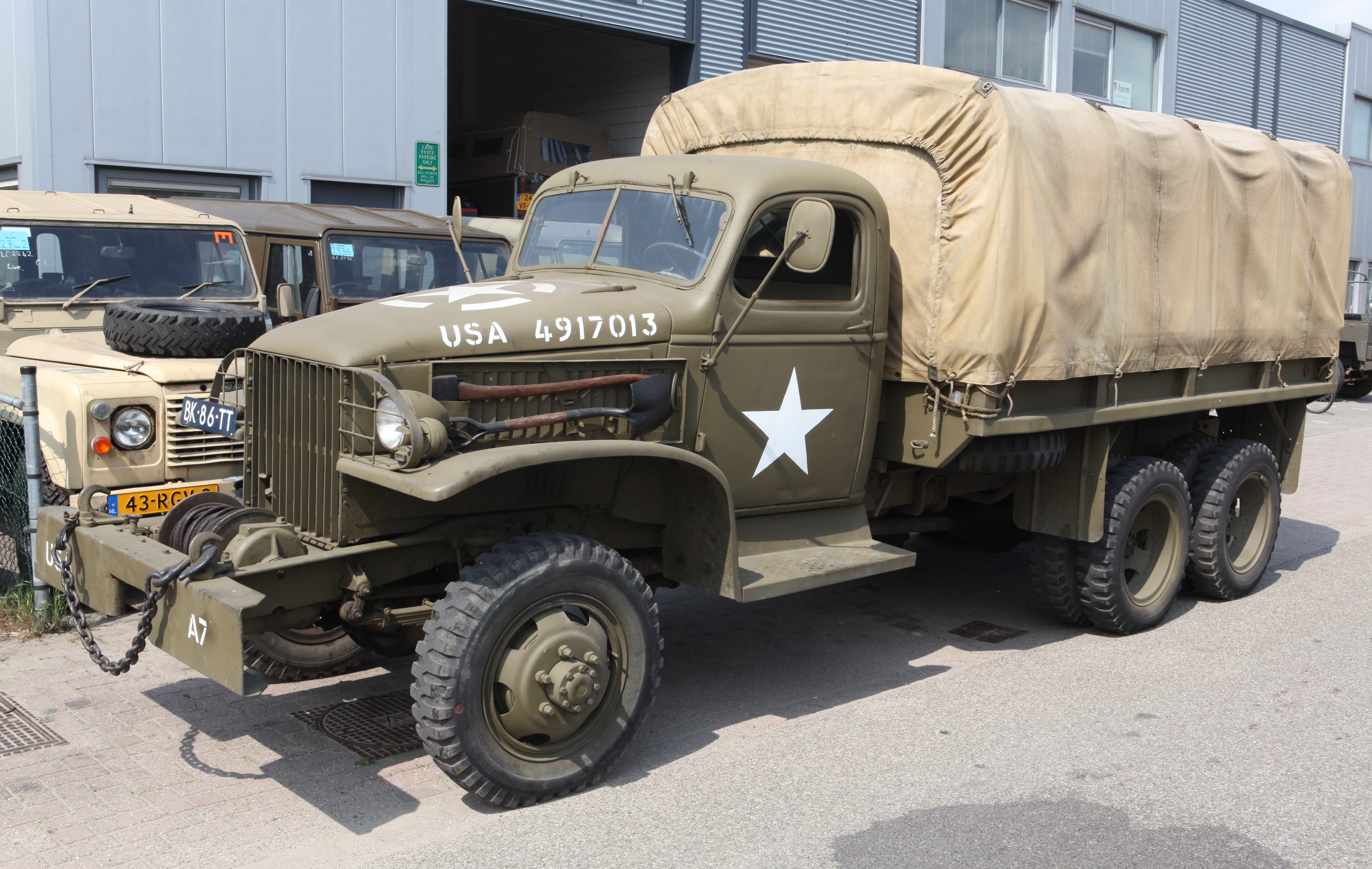 |
G.M.C. CCKW Long Wheel Base 353
"Deuce and a Half" truck from 1943 |
I'd rather have an Iltis-matching 1980's Bombardier MLVW, but they're a whole different price range.
- Having a reliable 12V charging system in the Iltis is needed in order to charge accessories. The current system runs off the battery and alternator and I believe gives off too much juice.
I'm still extremely interested in figuring out the "mysteries" of the Casey airfield, and the newly discovered buildings I hadn't seen last year at RCAF Station Parent. On one hand I don't want to get too focused on one place, but I do enjoy the location and the people. On the other hand, RCAF Station Chibougamau and other bases are waiting for me to visit... Unfortunately I'm not independently wealthy and do have to work for my money... so I only have so many days a year that I can go exploring. I still have a sliver of hope that I'll be able to go somewhere on the company dime and visit some of the Pinetree Line sites on someone else's dollar ;-)
What next? I honestly don't know. I have an invite to stay with a friend in Casey, QC in August, but it would be nice to get another camping trip in before then... We'll see!
In case you were wondering about the hotel, here is their contact info:
Motel 4 Saisons
33, Rue Principale
Parent, Québec
G0X 3P0
Tel: 819.667.2232
The following are the pictures I have assembled so far from my own shots, and the rest of the party.
Pictures by Steffan
Pictures by Jake
Pictures by Colin
Pictures by Tannis


