January 25, 2014

Galena to Arctic Red River Troposcatter Link

Canadian National Telegraphs (Canadian National Telegraph Co? / CNT) served the telecommunications needs of Canada's Western Arctic before it was merged in the 1970 with Northwest Telecommunications, now NorthwesTel.  In 1963 they were awarded the contract to provide the telecom backbone which would link DEW Line sites with command and control in the South.

Originally I thought these North-South troposcatter links were built by the military, but it turns out they were contracted to corporations (CNT in this case), mostly funded by the military, but other services (like long distance telephone) rode on their coat-tails, and local communities (arguably) benefited.

From what little documentation I could find, the troposcatter link between Galena Hill and Arctic Red River was one "hop", unlike the Hay River / Lady Franklin Point three hop link.  I would guess the rest of the way was by LOS Microwave(?).

Unfortunately, the satellite imagery I've been able to find is rather sub-par, and I cannot positively identify where the Galena Hill site is.  There are several mines in the area, so I'm uncertain what is mine-related or troposcatter facility related on the fuzzy imagery.  I believe the troposcatter antennas would have been near the NE end of Galena Hill between Elsa and Keno, since the giant "billboard" antennas had to point NNE toward Arctic Red River. The signal was being transmitted as a ~400Km skip off the troposphere, so the angle of the antenna would have been very shallow to the horizon.

View from Keno Hill, near Galena Hill
Courtesy of Branko Balaz
Original: http://www.mindat.org/photo-269114.html


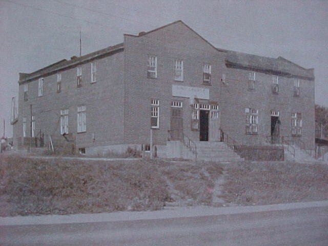
(From the Keno Mining Museum)
Courtesy of Branko Balaz
Original: http://www.mindat.org/photo-269109.html

Galena Hill Troposcatter Site (somewhere around there)

View Larger Map


At the other end of this troposcatter hop is Arctic Red River, now known as Tsiigehtchic. The imagery from that end is much better than the Galena Hill area.

Arctic Red River Troposcatter Site (67.41662, -133.60986)


View Larger Map


Putting it all together here is a map of the two sites and the link between them.


January 19, 2014

RCAF Station Holberg / CFS Holberg

Operational from January 1st 1954 to August 30th 1990, CFS Holberg's operations site atop Mt Brandes (50.6403, -128.1304) is still active today as a (Western) coastal radar station.  The domestic site, pump facilities, power plant, GATR site, and everything else was torn down in 1991.  I'd very much like to get better pictures of the area at the top of Mount Brandes where the old buildings were located, and see which survive in their original state today (versus new buildings built on their foundations).  The Air Defence Radar Veterans Association has analysed the latest Bing Sattelite imagery (here) and laid out where some of the facilities had been.  It would be great to pinpoint them on the ground.  I'm also curious if the foundations at the domestic site were dug up, or the buildings just bulldozed and taken away.

Refernces:
http://www.holberg.ca
http://www.radomes.org/museum/showsite.php?site=Holberg+AS,+BC,+CN
http://www.militarybruce.com/history/base-history_38.html
http://wikimapia.org/10160650/former-Holberg-radar-site
http://pinetreeline.org (many pictures from 1953 - 2005)
    (partially mirrored here: http://67.69.104.76:84/Pinetreeline/photos/photo21.html)


Challenges of backroad travel
Unknown (?) to the photographer Michael Shepard (flickr:mgsbird) this picture has been taken before, in 1976.

"A real "attention getter" on the road between Holberg and Port Hardy - July 1976. Courtesy Will Shank"


Domestic Site


View Larger Map

Operations Site


View Larger Map

January 12, 2014

The Pinetree Line Gap Filler Sites

Gap Filler Site Bridgewater, Maine
Photo Credit Linked Below
(Updated, updated again, and reposted)

In the late 1950s the Cold War was on, the Soviets and the Americans were pointing their missiles and bombers at each other, and Canada was in the middle, so to speak. There was never any doubt who's side we were on, but we were really "in the middle" territory wise. The Pinetree Line radar net was set up and drills were constantly being performed by the USAF Strategic Air Command in conjunction with the RCAF to test the radar operators and make sure the Pinetree Line would see the Soviet Bear coming over the North Pole.
There was one (well, probably many, but here's one) problem, the net was a loosely knit weave, and there were gaps.  The Pinetree Line radar stations were placed about 200-300km apart, on the top of the biggest hill they could find, close to the railroad, with access to water, and preferably not in a swamp.  (they did fill in some swamp land when that last part wasn't feasible)  Locally they'd need to establish a residential site, so it had to be live-able terrain, and be able to get supplies (that's where the rail access came in).  
"During the late 1950s another area of progress was the development and deployment of AN/FPS-14 and AN/FPS-18 gap-filler radars. Having a range of around sixty-five miles, these radars were placed in areas where it was thought enemy aircraft could fly low to avoid detection by the longer-range radars of the permanent and mobile radar networks. Gap-filler radar deployment peaked in December 1960 at 131 sites throughout the continental United States." - Searching The Skies - USAF Air Combat Command - June, 1997
Don't know anything about radar? I'm not so hot on the technology either. So let's dumb it down to what I understand. Each of these radar stations would act as both a bright-as-the-sun lighthouse (radar tho, not actual light), and at the same time as a spotter to "see" the incoming threat. Following me so far? Well, of every 300km you put a lighthouse that can see 200km in any direction you have a little overlap between them - but what if there's another mountain in the way? It would cast a shadow of sorts, and you might have a weak spot in the net, even with some designed overlap in the range of these radar stations.
After several years of operating the radar stations, from what I understand, the RCAF knew there were gaps in coverage, and not just pockets between the existing radar sites.  The radar network was great at caching giant flying things above 5000ft, but not so hot between 5000ft and 500ft.  The RCAF, with some encouragement from the Yanks, reached a decision to try and plug the gap.  In 1959 the RCAF started a Gap Filler project, which would place USAF-style "gap filler" stations spread out to create a new lower to the ground radar network that was meant to catch anything higher than 500ft above ground. The "gap filler" would be a ~70ft tower (like a fire-tower) with a radome on the top of it, and two supporting buildings below, housing the radar equipment and deisel generator.  Consutruction began on these mini-bases, but as they were building them, decisions were made and sites were changed.  Sites that were on the list, were relocated, some were removed entirely.  At any time there were up to 45 gap fillers on the planning board, and in 1964 after budget cuts, they were all cancelled - even those which had already been built.
So in 1964, there were 25 of these sites, partially built, to military specifications, some with a tower, and a couple of Steelox buildings set on concrete foundations, scattered across the Atlantic provinces, Ontario and Quebec - what to do?  The government sold them to other departments or private industry.  Today, some of the gap filler sites are still standing, and some in use; I've added their locations to my Cold War tourist bucket list.  I'd like to get some pictures of them.
Some of the sites at the time they were decommissioned were listed as 10% complete, while others were 95% complete.  Exactly what that meant isn't documented, but I suspect 10% means the foundation was poured, 95% (from what I can see from the sat imagery and read in reports) means the buildings were in place, but the equipment hadn't been moved in.  So, even if I don't "see" buildings at the 25 sites that were started on, via Google Maps, there's good reason to believe there is at least a concrete foundation to see.
With the advent of Google Maps, I have the opprtunity to "search from the air" for some of these locations before actually going to the middle of nowehere - where the satellite imagry is good enough, that is.  This also allows me to very accurately pinpoint the locations of the sites, and plot a course to them.  Some of the coordinates which are documented in the 1950s and 1960s documentation may have been poorly transcribed, as they seem inaccurate, or rough at best.  
 

Gap Filler Site C-3C - Algonquin Park, ON

View Larger Map

Gap Filler Site C-3A - Westport, ON

View Larger Map

Gap Filler Site C-16B - Atikokan, ON

View Larger Map

Once I have the locations in a Google Maps friendly format I'll post them to the blog.

I'd recommend viewing the map full screen (by clicking the little square at the top right of the map on the black bar).


 (credit to Ren L'Ecuyer (RIP) and Library and Archives Canada who provided much of the information I've been using to research these sites) References: http://www.radomes.org/museum/acwgapfiller.php

The Pinetree Line

I'm trying to migrate all my data regarding the locations of Cold War sites, stored in KMLs, KMZs, and Google Maps to the new Google Map Engine Lite (so far I haven't gone "Pro"); I've also discovered I've got a lot of duplicated data, and poor revision control.  Anyhow, here is my best guess at this moment as to what and where the Pinetree Line stations were that made up our Cold War air defence network.


A big thanks to radomes.org, lswilson.ca, and pinetreeline.org (defunct) for providing the information.

January 05, 2014

Mid-Canada Line Sector Control Station 500 - Winisk


Site Name: Mid-Canada Line Sector Control Station 500
Location: Winisk, Ontario
Built: 1956
Operational: 1957 - 1965 
Coordinates: 55.24440, -85.10944 
Lot/Concession:
Condition: Remediated (2011-2013) 
Current Ownership:Province of Ontario
Distance from paved road: Accessible by air, ice-road, water
Condition of access road: NA


Overview/Background:

Sector Control Stations along the Mid-Canada Line were the manned backbone of the radar system.  They were technical, organizational and transport hubs.  Sector Control Station 500 "Winisk" was located near the community of Winisk, that was wiped out by a flood in 1986 and relocated.  The site of SCS 500 was remediated between 2011 and 2013, some satellite photos even show the vehicles parked at the airstrip that were used for the remediation.

Southwest of the station is the airstrip, I believe Northeast of the station was a dredged channel allowing barges of fuel and supplies to be dropped off.

Directions:

There's not much hope of getting to Winisk in the summer without a plane, but there has previously been an ice road access.

Trip Report:

This is just a place-holder in case I ever do get to Winisk


Pictures:

Some of the last photos of Winisk before everything was torn down.
Photos courtesy of Julian Pullara, and were taken in the fall of 2012.

Winisk air strip


Winisk Fire Hall


Road from the air strip to the station


The Winisk air strip control tower


Larry Wilson has vintage pictures on his web site of SCS 500
http://www.lswilson.ca/scs500.htm


Maps:


View Larger Map

January 01, 2014

DEW Line - Hay River to Lady Franklin Point troposcatter link

I don't spend a lot of time researching the DEW Line, but the Hay River troposcatter link between Hay River and Lady Franklin Point caught my eye. In 1960 CNT (Canadian Telecomms Company) built the link for the US Military to run DEW line comms over it, and piggy-backed civilian phone service over it as well.  Sometime after the DEW line was decommissioned, and this antiquated link to northern communities was no longer needed, it was sold to private interests... well, here's the whole story:

Hay River’s parabolic antenna turns 50 this year
(Published February 4, 2013)
Hay River Troposcatter Antenna
Photo Credit: Adventure Caravans
http://ahome4u.net/nwt/day%2020.html
Regardless of whether you go by Robert Dean’s property on Vale Island by land or water, you can’t help but be drawn to the enormous dish that points to the sky.Its unorthodox appearance and location has probably confounded hundreds of people throughout the years.


“When I was a child, I thought it was a drive-in movie screen for boats,” said Hay Riverite Kate Latour.

In fact, the 60-foot billboard shaped antennas were part of the Cold War’s Distant Early Warning System (DEW Line), built in 1963 along with other radar equipment to monitor Soviet bombers and prevent land and water invasions in the Arctic.

The antenna would transmit and receive signals by tropospheric scatter, a method of bouncing microwave signals off the troposphere – the lowest portion of Earth’s atmosphere – and then having them picked up by receiver stations as far away as the signal scatters.

Around 1975, when the Canadian military stopped using the facility, it was operated by Canadian National Telecommunications (CNT), a subsidiary of Canadian National Railways, and turned into a way to communicate with northern sites.

Poul Osted’s aunt worked as a phone operator at the facility.
Hay River Troposcatter Antenna
Photo Credit: Adventure Caravans
http://ahome4u.net/nwt/day%2020.html

“Back then, this was as far north as the phone lines came,” he said. “The signals received by the antenna would be sent out via telephone lines to receiver stations down south. Then they were used for civilian purposes and every time a person would call the site to be connected elsewhere, everyone on the line could hear the conversation, just like on a CB radio.”

At that time, a young Northwestel employee by the name of Robert Stephens discovered the facility, and spent some time there on a microwave technician training course while it was still being operated by CNT.

In the early ’80s, Stephens was living in Edmonton and began searching for equipment he could use to establish a dedicated Search for Extraterrestrial Intelligence (SETI) program.

When he came back to Hay River in 1981 and discovered that the site had been decommissioned, he was able to purchase the antennas for the relatively low cost of a dollar, according to his website.

“Before I could remove the antennas for relocation to a site in Alberta, CNT decided to sell the property by auction,” Stephens said in a recent e-mail.

He said he pleaded his case before town council in 1983, laying out his plans to establish a radio observatory at the site. His motives were backed by extensive research in the form of a 23,000-word report, concluding that the site was a suitable location for his project.

With very limited funds, he made the highest bid he could without borrowing any money. The town also entered a bid to secure the site for the proposed radio observatory.

The eight-acre property was put on the block in 1985 and was purchased by Robert Dean, who came out on top with a bid under $20,000.

As a result, Dean and Stephens negotiated a five-year lease agreement. After selling off most of his personal possessions in order to buy various pieces of equipment, Stephens was finally able to start monitoring the skies for extraterrestrial signals.

From 1985 to 1989, his work gained international attention. The American television network NBC even sent a news crew to the site in 1987 to do a story on it. The same year, Stephens hosted his first undergraduate university student, who came to the site for some hands-on observing experience.

A July 1987 Hub article described a campaign drive, in which he travelled across Canada and the United States to drum up support for his project. It also documents his mounting debt, which stood at $50,000 at the time.

Without a constant source of funding, Stephens had no way of paying his property-lease payments and mounting utility bills. In 1989, he was forced to abandon his project and leave Hay River altogether, and now lives in Ontario.

Dean tore down one of the antennas, to Stephens’ dismay, and left another standing, because “it was kind of a landmark,” he said.

“Years later, I found out Dean had torn down one of the dishes after I’d left,” Stephens said. “My use of the site as an astronomical radio observatory was completely harmonious with the existence of the structures as a navigational aid for fishermen and the bit of tourist interest that my repurposing the site had created.”

Reached last week in Arizona, Dean said he still didn’t have any plans for the last remaining dish.

“It’s a real curiosity piece,” he said, adding tourists drop by once in a while to ask him questions about it.

In a 2001 News/North story, he mentioned his desire would be for an artist to come by and paint a giant mural on the dish’s smooth surface.

– Myle Dolphin
http://www.hayriverhub.com/2013/02/hay-rivers-parabolic-antenna-turns-50-this-year/
Furthermore
"In 1960 Canadian National Telecommunications installed a tropospheric scatterwave (troposcatter) system to link up with Distant Early Warning (DEW) line stations in Canada's north. This was also a United States Department of Defence contract. It also, in the process, improved civilian communications in the North. Technology and the commercial market had finally advanced to the point where the provision of commercial communications for Canada's north had become viable. For the military this marked the milestone where it went from the provider of communications to the customer." http://www.c-and-e-museum.org/chap6_e2.htm
 

Location of Hay River Troposcatter Antennas
atlas.gc.ca


View Larger Map


I believe Snare Rapids is next hop, and it is also the site of a hydro electric dam.  I cannot find any imagery of the troposcatter antennas, or exact location of the antennas.


View Larger Map


Port Radium has excellent satellite imagery on Google Maps, which clearly shows the ruins of the troposcatter antennas - two pointing South and two pointing North.


View Larger Map


Lady Franklin Point is a sprawling unmanned military facility, and no specific location can be pinpointed by today's satellite imagery showing where the troposcatter antennas were.


Armstrong AS / RCAF Station Armstrong / CFS Armstrong


CFS Armstrong was built quite remotely by the USAF in 1952 and became operational in 1954 as the Armstrong Air Station, it was handed over to the Canadian RCAF in 1963, and became CFS Armstrong after unification in 1967. As other radar stations became more powerful it became redundant and was decommissioned in 1974. Most of the base still stands, including the foundation of the radomes. From what I gather, the more remote the radar station, the better preserved it has been - it seems like nobody goes there because it's really remote - perfect!


The location of  the operations site and domestic site are obvious, but the GATR, RX and TX sites I'd like to locate as well.  From the available imagery I can only identify one of them (east of the operations site, at the end of the road) and I hope I can find the others when I have boots on the ground.  (NB, In the 1950s there were always two communications sites; one for transmit, one for receive; about 10 years later the higher powered GATR sites were built)

I do not currently know where the CFS Armstrong GATR site would have been, which would have been built in the early 1960s, I suspect.  I also do not know where the "cabins" were that were supposedly built by German prisoners of war in the years before the station was built.


View Larger Map
 

The local town of Armstrong was a short trip away and the rail brought in most of the base supplies.
Here is the site plan of how the base was paid out:

What places do I need to see when I'm in Armstrong?

Well, clearly The King George Hotel/Bar is a must.  By military standards it was a rough hotel/bar, so I can only imagine what stories its walls hold... It has been renovated, but it is still there under a new name and new management (uh, I think?  I'd hope!) now called "Chateau North"

Photo Credit: Fred Rasmussen (1971)
Seeing the airport East of town is also essential.  I hope the hanger shown below is still standing.  Taking pictures of how it stands today would be well worth he trip.

(L-R) Bob Wanner, Bob Landenman, Kelly at the airport
April 1955. (Credit Bob Wanner)

Armstrong International Airport
August 1962 (Credit Keith Robinson )


Checking out the plane at Armstrong airport before take off
July 1958 (Credit Wayne Mathern)

This L-20 aircraft was attached to the 914th AC&W Squadron
April 1960 (Credit Greg Clarke)
For an overhead view of the station from 2001 we go to Bob Warner's images, photos he took while circling above.


More areal views:

Armstrong AFS - February 1960
(Credit: Greg Clarke)

Aerial close up of Operations Site - 9 May 1962
(Credit: National Photo Library)

Aerial photo of the radar station - March 1969
(Credit: National Photo Library)

North Bay, Ontario - BOMARC Site


I've mentioned The CFB North Bay BOMARC missile site before, a couple of times, so I wont go into too much detail.

Now decommissioned, the site is a self-storage location and open during business hours.  The owner is friendly and interested in the history of the site as well, so if you have any original information from Cold War research, he'd be interested in hearing about it!  I wasn't the first Cold War tourist to drop by when I did in August 2013.


View Larger Map


Aerial photo of the SAM site at North Bay - 1967. Courtesy of The NBC Group
I was thrilled to have been invited to see the steam tunnels below the launchers and get a quick tour between two of the hatches to the surface.  The launchers were powered by steam, so the tunnels housed a massive number of wires controlling the electronics, and several pipes for the hot water.  Most of the wires have been taken for salvage, but the pipe, and the conduit the wires sat on, is still there.

Tunnels with conduit and pipe under the North Bay BOMARC Launch Site - Aug 27th, 2013
Here are the rest of the North Bay BOMARC Site photos

Created with Admarket's flickrSLiDR.


RCAF Station St. Sylvestre / CFS St. Sylvestre


Operational from 1953 to 1964 most of the residential part of the station was demolished, but a few buildings remain at the operations site at the top of the nearby mountain and RX site is nearby.  I'm not sure who owns the property, at one time someone had a gate and was charging a toll to see the ruins of CFS St. Sylvestre.  There seem to be at least two active microwave repeaters at the top, so I'm sure the road is in good shape.


View Larger Map


RCAF Station Mont Apica / CFS Mont Apica

CFS Mont Apica has been almost completely remediated.  Not much is left other than some fence and a tower at the top of the hill.  I believe some if not most of the land is still owned by the Department of National Defence, but if you can get to the top of the mountain the view is supposed to be breathtaking... actually, here's a video someone took of their trip to the top, starting at the bottom


View Larger Map

RCAF Station Edgar / CFS Edgar

RCAF Station Edgar / CFS Edgar was built in 1953 as part of the Pinetree Line radar defence network; as both a Ground-Control Intercept station and an Early Warning Detection station.  It was sold to the Province of Ontario and turned into the Edgar Adult Occupational Centre, which closed in 1999.    Latest reports suggest that a developer bought the land in 2011 for $2500, has leveled all the buildings, and will build 82 houses on the site.  

When I eventually visit I expect I'll be severely disappointed with what I see at the site.


View Larger Map


Sioux Lookout Air Station / RCAF Station Sioux Lookout / CFS Sioux Lookout

Sioux Lookout Air Station began construction in 1952 and was operational by 1953. In 1962 the station was handed over to the RCAF and as part of unification in 1967 was renamed CFS Sioux Lookout, which lasted as part of the Canadian Forces defence structure until 1987 when its doors were finally closed. The station sits West, across the river, from the town of Sioux Lookout. It seems to still be accessible by road, and it seems that the buildings are still intact. I haven't read much about the state of CFS Sioux Lookout, the more remote the bases are, the less people visit them - for better or worse, it's hard to find info regarding their current state!

Sioux Lookout is private property, and rumour has it either a homestead or skidoo repair business.  There are lots of gates and no trespassing signs from what I have heard. It is another location I will need to get permission from the owners to visit prior to visiting. 

Location of CFS Sioux Lookout
Toporama - atlas.gc.ca


View Larger Map


RCAF Station Pagwa


RCAF Station Pagwa was one of the Pinetree Line radar stations guarding the north from the threat of Soviet Cold War bombers, and operated from 1952 to 1963 by the USAF as Pagwa Air Station, and 1963 to 1966 by the RCAF as RCAF Station Pagwa.  It was also the 1st of the Pinetree Line stations to be decommissioned.  Overall it had a poor "view" for a radar site, and as the power of the other radar stations grew, they elected to close this one first. It had a small residential site with administrative buildings, and a tri-gravel-runway setup similar to Ramore, built around the same time, to the same specifications. As with most Pinetree Line sites, it is right beside the railway, making it easy to get supplies. Unlike Lowther, RCAF Station Pagwa is well off the beaten path away from Highway 11.

From all indications that I can find online, RCAF Station Pagwa has been scrubbed off the face of the earth.  I expect to find, at most, a few foundations... but I'm eager to make the pilgrimage and see what the area looks like.


View Larger Map

Photo Credit: TBA

Photo Credit: TBA
Photo Credit: TBA

Photo Credit: TBA

Photo Credit: TBA