November 17, 2014

United States Strategic Air Command Facilities in Canada


I'm always surprised to find new types of installations or buildings that I didn't know existed.  I know that I know a very small corner of a much bigger pie of Cold War knowledge, but I had no idea I'd missed an entire class of hardened structures from the 1950s!

Moleholes
The "Molehole" (aka Mole-hole, or Mole Hole) is a hardened Alert building that would house, feed, and entertain American air crews flying B-47 Straojets, Air-refueling tankers like the KC-97, or other long range aviation assets' air crews, while they were waiting for the order to strike the Soviet Union.  They came in three sizes globally, depending on where and what kind of deployment of aircraft they would support; 18,000 square feet (70 men); 22,500 square feet (100 men); and, 31,000 square feet (150 men) - different versions of the molehole were built at SAC bases worldwide.  The six moleholes in Canada were all of the 18000sq ft / 70 man variety and were completely built by late 1959 or 1960.

"...alert areas went in at 65 SAC installations nationwide during 1956 to 1960, with a partially below ground, reinforced concrete alert quarters for the pilots built at each apron. The alert quarters, called moleholes, were in effect partially hardened, and not surprisingly were designed by the same Omaha architectural-engineering firm responsible for SAC’s underground command center of this same period, Leo A. Daly. With dispersal, SAC made some of its alert aprons bomber-only and some tanker. By the early 1960s bombers and tankers were sometimes on alert at a single installation—with tanker pens in addition to the Christmas tree configuration, and with house trailers again brought to the tarmac."
- "Cold War Infrastructure for Strategic Air Command: The Bomber Mission"
Prepared for; Headquarters, Air Combat Command, Langley AFB, Virginia

Hangers
For a hanger to fit an entire heavy bomber, medium bomber, or air refueling tanker, it needs to be quite large.  A more resource efficient way would be building a hanger that just barely fit the plane to keep the mechanics and hardware out of the elements, and could close the door around the ass end that was sticking outside - that was exactly what the United States Strategic Air Command did in the 1950s.  Those distinct looking hangers are still at several previously SAC airstrips across the world.

The US Strategic Air Command had six such bases where SAC assets were located in Canada.

    Namao (Edmonton / Lancaster Park AB)
    Cold Lake (AB)
    Churchill (MB)
    Frobisher (Iqaluit)
    Goose Bay (NL)
    Ernest Harmon AFB (Stephenville, NL) 


Namao, Alberta (3955th Air Base Squadron)
(...now CFB Edmonton -Lancaster Park)

Built as a refuelling base by the SAC, crews would be stationed for 2-3 month rotations from their home base in the United States.

RCAF Station Namao became Canadian Forces Base Edmonton (Lancaster Park) after unification in 1968.

At least one "nose hanger" is still in existence on the base, conveniently right near the molehole.

Molehole Location: 53.6595, -113.4467
The molehole looks to still be in use, but I do not know by which part of the Canadian Forces.  It is listed by the Department of Treasury as being federal building # 124206, in fair condition, with 2,147 sq. m. (23110.12 sq ft) of floor space - which doesn't jive with previous information!

Photo and Caption Credit to Harold McNeill
"c1961 A KC-97 Tanker refuels one of the USAF SAC bombers high over the Canadian Arctic.
This scene would have been repeated many times a day over nearly a decade.
The bombers, loaded with nuclear weapons,
were prepared to strike deep within Russia at the first sign
of an attack against the United States."


View Larger Map

View Larger Map

Seriously? There's a trailer park beside this one?  GO ARMY! 


Cold Lake, Alberta (3950th Air Base Squadron)

Molehole Location: 54.3948, -110.2638
Built as a refuelling base by the SAC, crews would be stationed for 2-3 month rotations from their home base in the United States.

Still in use by the Canadian Forces today, I believe called Building 104, was expanded with an addition.  The Molehole at CFB Cold Lake gets usedfrequently as the Air Force Tactical Training Centre (AFTTC)

Building 104 @ CFB Cold Lake
https://www.flickr.com/photos/59434634@N05/7973074760


View Larger Map


Churchill, Manitoba (3949th Air Base Squadron)

Molehole: End of Runway 33 - Destroyed

Courtesy Ivan Abolit


Original SAC hangers are still in existence on the former base.


Frobisher Air Base, Nunavut

Molehole: Unknown - Presumed Destroyed
SAC refuelling and/or Reconnaissance Base
Home of the USAF Strategic Air Command refuelling operation at Frobisher, an SAC base closed in 1963, when its refuelling operations were mostly taken up by tankers flying out of Goose Bay.

Original Nose Hanger:


Goose Bay, Labrador

(aka Building 248 per DND 5 Wing Goose Bay Area Site Plan, 1998)
"Goose Bay Alert Facility or Mole Hole taken in early 1962 by Hank Brown."

Note the Luria Engineering multi-purpose wing hangars on the right
two of which have been demolished, two remain
"301st AREFS KC-97Gs lined up at Goose Bay in 1962 on alert. The closest aircraft is 52-0850. The second aircraft is 52-0872, another 301st ARS aircraft. The one after that is 52-0857. The 301st AREFS had a very dark green diagonal stripe on the tail during the time."

CFB Goose Bay - 2001
 
CFB Goose Bay - 2001
 
CFB Goose Bay - 2001


Molehole: 53.3086, -60.4017
Reportedly, the molehole was still in use in 2002; I don't have any more recent information than that.  
According the the Treasury Board Secretariat the building is "occupied" (as opposed to vacant.  It is building number 125892 in their registry, which shows it was built in 1959 (which matches my other information), and measures 2716 sq. m. (29234.8 sq ft) which does *not* jive with the information I had.
At least two nose-hangers are in existence, and I have marked the map below with the other two (which are shown in the picture above!). 


View Larger Map


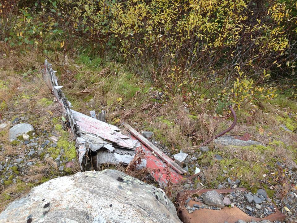
"Remains of former USAF storage bunker - 1 October 1983."
Credit: Barry Yager

"Remains of former USAF secure area - 1 October 1983"
Credit: Barry Yager


Ernest Harmon AFB, Newfoundland (4081st Strategic Wing)

Molehill: 48.5534, -58.5399
From what I read online, this molehole is now an accountant's office, and self-storage facility.
 

View Larger Map

Photo Credit: Shannon K. Green
via: http://planecrashgirl.blogspot.ca/2013/08/the-worst-disaster-in-history-of.html


At least four nose-hangers are clearly visible on the property of the former base. I believe the below is an example of a Luria Engineering multi-purpose wing hangar.

Photo Credit: Peter Mansell


The Big Picture


Sources:
    Terry L Horstead
    The City of Ottawa
    http://www.geocities.ws/kc97stratofreighter/301ars.html
    http://albertacanada.com/Cold_Lake_Hot_Shots_%28June_2010%29.pdf
    http://www.mcneillifestories.com/fire-walkers-chapter-1-a-nuclear-challenge/
    http://www.globalsecurity.org/wmd/facility/bomber_alert.htm
    US Nuclear Weapons in Canada, John Clearwater
    John Clearwater
    http://cryptocomb.org/Cold%20War%20Infrastructure%20for%20Strategic%20Air%20Command-The%20Bomber%20Mission.pdf

      October 19, 2014

      Trip Report: Mid-Canada Line Site 060 and back

      Between October 14th and October 18th I was fortunate enough to take a trip into Northern (Northeastern) Ontario to see a few Cold War (and Cold-War Adjacent) sites that were on my bucket list, and was lucky enough to have a travelling companion who was excited to see some of same places as well.  Thank you RH for coming!  We covered over 2,700 km in four days; saw many things, missed some things, took pictures at roadside attractions, didn't die, but the weather didn't really cooperate.  On the other hand, the weather could have been worse, so I shouldn't really complain!


      Bo-Mark Motel

      (North Bay, Ontario)

      On the first night we decided to hit a Motel; it had been raining pretty steadily all day.  Just down the road from the North Bay BOMARC launch facility we found the Bo-Mark Motel... see what they did there?  Naturally, we had to stay there.  From the outside, the Motel looked a little dated, but it was extremely well cared for inside, looks like it has been renovated, and was very clean.  I was impressed.  I would recommend it to any weary travelers.  They were full by 11pm, so be early!  As it turns out, the dog loves sleeping in the truck, and hates sleeping in a motel, so I ended up sleeping in the back of the Suburban with the dog so he didn’t bark all night - it's quite comfortable back there!


      Canadian Forces Museum of Aerospace Defence

      (North Bay, Ontario)

      This radar console was used by the
      SAGE system from 1963-1983;
      please note the cigarette lighter
      and ashtray in the unit
      I was very pleased to finally see the Canadian Forces Museum of Aerospace Defence in North Bay.  Their dedicated staff have the support of the Canadian Forces and understand the value of preserving the CF's rich air defence history.  The museum has recently been renovated and has exhibits dating back to WWI; of course, my interest is mainly focused around the Cold War, and I was both thrilled and impressed with the quantity and quality of the materials at the exhibit.  The staff of the museum are extremely knowledgeable and passionate about their work, you will not be disappointed.  If you are passing through North Bay and have an interest in Canadian Air Defence, you should really stop in.  Check their web site for hours www.aerospacedefence.ca

      Cockpit selfie in the
      CT-133 Silveratar aka "T-Bird"
      What about the underground bunker?  Unfortunately there are currently no tours of the former headquarters underground, it is currently being demilitarized and stripped of all military equipment.  Very unfortunate.  Considering how excited I get to see a bare patch of land where a base once stood, I really don’t care that there isn't anything "down in the hole", I don't need a museum down there, I don't even need a formal tour; just open the door!


      Here is the official video of the descent into "The Hole":


      Jack Garland Airport (YYB)

      (North Bay, Ontario)

      ~10,000ft of runway
      capable of supporting any plane in the world.
      The administration of the Jack Garland Airport in North Bay astounded me by proving escorted access inside the wire to the Cold-War-era Quick Reaction Alert (QRA) hangers and former munitions storage facility within the grounds of what is now the Jack Garland Airport.  Previously, in case you were not aware, the now-civilian airport was part of CFB North Bay.  The airport's administration are well versed in the history of their airport and appreciate that individuals such as myself are interested in seeing what once would have been inaccessible to the public.  I am very grateful they were so courteous and answered every question possible.  Thanks to them, I was finally able to see the inside of a fairly unmodernised QRA hanger, and see the original three piece hanger doors which are often upgraded to "modern" doors as they break, due to the difficulty of repairing the originals.  They also granted access to the munitions bunker, but I discovered three other people this year has also been knocking; also looking to see those buildings for their own curiosity, hobbies and perhaps business.  If you are them, get in touch!


      Former CFB North Bay Quick Reaction Alert (QRA) Hangers

      (Jack Garland Airport (YYB))
      (North Bay, Ontario)

      The inside of the right-most
      QRA Hanger
      QRA hangers would have been built to keep all-weather interceptors (originally the Avro Canada CF-100 Canuck) fueled for take off, and have pilots stationed right next door in a small barracks building equipped with kitchen and sleeping facilities.  The idea was to have the interceptors fully ready to take flight at a moment's notice.  After initially being used for the CF-100, those same Cold-War-era QRA hangers have continued to be used for every generation of Canadian fighter jet since; even for Canada's latest CF-188 interceptors.

      As it was explained to me; the hanger door was originally designed so that the two side doors would swing to the side, the middle door would lift (like a typical garage door), and the two supports would fold up and out of the way to opposite sides.  This design, and having front and back doors open, allows planes to power up and fly right from the hanger, rather than being pulled out before starting up their engines.  The doors are massive, and the counterweights and chains that are part of the mechanism are quite impressive too.  I was told that the leftmost hanger (Northmost in the below picture) burned to the ground, and the pilot's barracks was essentially condemned and demolished years ago.


      Former CFB North Bay Munitions Storage Bunkers

      (Jack Garland Airport (YYB))
      (North Bay, Ontario)

      Munitions Storage Bunkers
      Reinforced blast shield
      As I've mentioned previously; if there's a military airport, there has to be safe storage nearby to store any munitions that might fly in on said aircraft, and that storage needs to meet certain standards that correspond with the munitions that would be stored there.  Property on the location of the former CFB North Bay aerodrome conforms to that theory with earthen-buried bunkers at the end of the runway.  After the airport was split off from CFB North Bay in the 1990s, the bunkers were not demolished, but instead turned into storage for airport-related equipment.  The bunkers are extremely reinforced, engineered to withstand the potential blast from their munitions going off, and buffer any shrapnel or blast from hitting the airport by diverting it upwards (if I understand the design properly).  They show only minor cracks and rust, and are shockingly solid.  All electrical conduits are airtight and to spec for environments where there could be explosives present; I've never seen anything like it!


      Near Fraserdale, Ontario


      We set up camp near the Fraserdale rail siding near the Abitibi Canyon dam. 
      Looking Eastward
      near Fraserdale
      Considering it was quite late when we set camp, it seemed like the best place we could find in the dark.  Flat, dry-ish after a day of rain, and off the side of an access road by a rail siding.  It was unlikely that anyone would be by, and it seemed safe enough. The next morning one of the locals who lived in Fraserdale stopped by to say Hi, as I'm sure we were a curious site.  I was struck by how friendly everyone was on the trip.  Fraserdale is certainly sparsely populated, but I didn't see any "scary" derelict housing (as I had expected).  I used my camp stove in the morning to make MREs for breakfast, and made coffee before packing up and heading toward Relay, Ontario.


      Mid-Canada Line Site 060

      (Relay, Ontario)

      The MCL site at Relay was already cleaned up, so, except for one pad of concrete and a couple of chopped off telephone polls, there wasn't much... I was struck by how huge the area was that was remediated, and how there's absolutely no hint of the troposcatter antennas, buildings, or anything.
      The road to get to the site was ~5km long, and easily walkable within an hour.  What seem to be drainage ditched have been cut into the road, and mesh fastened to the ground presumably to prevent erosion.  These ditches, while inconvenient, were not hard to jump over, and we did not get too wet.  One of the ditches has been dammed by a beaver on the West side, making quite the lake on the West side of the road, and covering the road with water.

      View of the former MCL Site 060 from the Northwest end, looking SSE
      Jasper, our 8 month old Great Pyrenees posing like a professional model by the train tracks, picture taken looking East
      This beautiful Vulpes vulpes, the Northern Red Fox, didn't stick around long when he saw Jasper - but was very curious about us before running off into the tree line.


      Travelling from Relay ON to Otter Rapids ON


      Prior to taking the trip, using the latest Bing Satellite imagery, I was able to see a path existed on the West side of  the Abitibi, but I couldn’t tell exactly how well maintained that road was.  As it turns out, it's not terrible, but it was a little scary at times.  The road does have mile-markers along the way to give you a hint that you're on the right track, and overall at every road juncture the most travelled road is the "right" road to take when travelling from Relay to Otter Rapids.  I would not recommend this road for any car, it will bottom out and destroy the vehicle.  A 4WD Jeep, truck or large SUV required to make it, IMHO.


      Otter Rapids Dam

      (Otter Rapids, Ontario)

      Overcast skies put a damper on the photography, but the size and power of the water that is flowing through the dam is mind-boggling.  I think this is somewhere more people should make the trip to see.  If I understand correctly, a lot of Toronto's power comes from this generating station.

      Unfortunately I did not get any response to my attempts to contact OPG, so I was unable to schedule a tour of the facility.  While Hydro Quebec publicly offers free tours of many of their remote sites, I get the impression OPG doesn't feel any reason to do so.  Thanks a lot, eh.


      New Post Falls

      (between the Otter Rapids and Abitibi Canyon Dams)

      This part of the trip was a failure, partially due to using up all my testosterone and bravery on the segment between Relay and Otter Rapids earlier in the day, partially because we were running out of light, and the weather looked like it was going to suck even more than it had been.  Let me explain.

      The plan was to leave the main road (Otter Rapids Road / Green circle), travel along a trail to a spot that has a marked walking trail (Blue circle), and walk to the bottom of where the water from the falls comes out and is more calm; a 15 minute "hike".

      Maybe I should have gunned it?
      However, along the way we found a large body of water on the trail, and I was concerned that I didn't have sufficient self recovery tools aboard to SS Suburban in case we got stuck or soaked something electrical.  I wasn't sure of the depth or condition of the road under the water, so we decided not to go to New Post Falls that day.  Also influencing the decision was I didn't know exactly how many km we were from the trail head.  Further influencing the decision to turn back was the time of day, less than a half hour from sun down, and it was raining off and on.  The gods were not smiling on us, so we turned back.

      Now that I look at the trail on Bing's satellite imagery again, I can see the water hazard on the road just ahead of where we stopped the Suburban.  Also in hindsight, I can see that the waterfall would have been ~6km ahead if we'd walked it from there.  Good to know for next time.

      Travelling back to the Abitibi Canyon Dam to cross over in the dark was quite easy on the exceptionally good unpaved road on the East side of the Abitibi River; completely unlike the road on the West side of the river we had taken earlier.


      Leave the main road - Green
      Planned park and hike - Blue
      Significant water on road - Red

      Water Hazard as shown on Bing Maps


      Country Inn Bar and Grill

      (Val Gagne, Ontario)

      We made it back as far as Val Gagne that evening and got a room out of the rain.  Jasper was initially very twitchy, as every noise in the Motel made him want to check and see what was what.  Eventually he fell into a deep-enough sleep and let us sleep as well.

      While I was apprehensive, since there is an Adult Entertainment establishment next door, the room was actually pretty comfortable, and the bathroom was nice enough (tho dated looking).  Their coffee was absolutely terrible, but their breakfast was delicious - fantastic bacon, sausages and eggs won me over.

      Photo Courtesy of RH

      Mid-Canada Line Site 070

      (Mount Kempis, Ontario)

      While there is really nothing left of the Kempis Mountain Troposcatter site
      (per my previous blog entries) we did stop to see the view since it seemed appropriate; We'd been to the Air Defence Museum in North Bay, and the next hop in the network at Relay after all!

      View of Ramore from Kempis Mountain

      In conclusion...


      Every time I take a trip like this I learn a little more about how to make the next one better.  As I chew on the experience I expect to make a list of ways I could have improved it... not to take away from the awesome time that I did have, but to say; what could I do better next time?


      October 08, 2014

      Trip Planning: To Mid-Canada Line Site 060... and back.

      New Post Falls
      Photo: Andrew McLachlan
      Here is the plan for the next trip.

      Mid-Canada Line (MCL) sites are rather hard to get to, for me anyway, since the majority were placed along the 55th Parallel.  There are, however, a few sites which stretched South, to bounce the information gathered by the MCL to North Bay.  Those sites were, of course, the troposcatter repeaters stretching South from James Bay.

      The Southmost troposcatter repeater is Site 070 (Kempis Mountain, or Mount Kempis) which I've seen before, but hope to see again on my next trip.  It is fully remediated, but provides a fantastic view.

      The next hop in the former troposcatter network is 200 km away at Site 060, in Relay, Ontario - a now-non-existent place which once housed diesel generators and radio equipment.  That's where I want to get to. I've never been, and it's pretty much as far North (the 50th Parallel) as you can get in Northeastern Ontario without a canoe.

      I will, however, push farther North than that, and aim to get to the Otter Rapids Generating Station, New Post Falls, and see the Abitibi Canyon Dam on the way back.

      Two stops in North Bay are planned, and I will document them extensively after they happen.

      I had originally been planning to see several of the air strips which were created or upgraded as part of the Pinetree Line project in the early 1950s... however, I discovered there arent many original buildings left at any of the sites... so why bother; sorry to say... My objective was to go somewhere few others have been, and fewer have photographed or documented.  MCL Site 060 at Relay, Ontario fits that bill.


      September 27, 2014

      1958 Bell Quebec-Labrador Troposcatter Network


      Background:

      I'm interested in pinpointing the exact locations of each of the sites involved in the Bell troposcatter network built between Goose Bay and Sept-Îles betwen 1957-1958.  Using information from the September 1966 IEEE Xplore publication, periodicals of the time, and some help, I think I've nailed down more or less where the sites were.  It helped that the newspaper articles of the time mentioned the names of the locations for me!  The illustration below from the IEEE shows the general layout of the sites (along the line marked "10")

      In 1958 Bell Telephone Co. of Canada made a radio network using troposheric scatter (troposcatter) comprised of 5 "spans" (hops) between 6 points on the map ranging in distance between 80 miles to 150 miles apart.  This was to relay military as well as civilian communications from Labrador to Sept-Îles, where terrestrial microwave and then land lines would be available to take the communications the rest of the way.  These are the same style of troposcatter billboard antennas as were used for the Mid-Canada Line connection to Mount Kempis, which was also built by Bell; so they were basically built to the same specification, by the same people. 

      I've illustrated the sites on Google Maps (above) to show where I believe the general or specific locations of the troposcatter antennas were based on information, some deductive reasoning, and some help from Alex Lupták.

      Melville Air Station (Melville AS)


      Melville AS Bell Troposheric Scatter Site
      Photo Courtesy of Pinetreeline.org
      Exact Photo Credit TBD


      Site Name: Melville Air Station (Melville AS)
      Location: Goose Bay, NL
      Built: 1957-1958
      Operational: Unknown
      Coordinates: 53.29448, -60.54243 (013F07)
      Lot/Concession:
      Condition: Remediated
      Current Ownership: Unknown
      Distance from paved road: Unknown
      Condition of access road: Unknown

      Melville Air Station (near Goose Bay) has been remediated, but where the antennas were located is easy enough to figure out by using vintage pictures.  The distance between Melville and Sona Lake is ~150 miles, the distance we're told in the IEEE publication was the longest "hop" in the network.  


      Melville Air Station Bell Troposcatter Antenna Location
      atlas.gc.ca


      View Larger Map


      Sona Lake


      Site Name: Sona Lake
      Location: Near Churchill Falls
      Built: 1957-1958
      Operational: Unknown
      Coordinates:  53.5640, -63.8454 (023H09)
      Lot/Concession: Unknown
      Condition: Partially Remediated
      Current Ownership: Unknown
      Distance from paved road: Unknown
      Condition of access road: Poor

      The Sona Lake site would have been a troposcatter repeater between Melville and Emeril.  Bing satellite imagery shows a flat spot at the end of a trail to the top of Sona Hill.  From comments on the blog, help from PL Tremblay, and thanks to the the Nalcor and Hydro Quebec guys locally, this is where I believe the Sona Lake was located.  The height is right, the site should provide a view to both Emeril to the West and Melville to the East. Power for this site would likely have been provided by on-site Diesel generators since there wasn't much of a power grid in that area in the late 1950s.


      Emeril

      Emeril(?) Winter 1972-1973
      Photo Credit: Robert Smith Ghobhain
      Site Name: Emeril, Labrador
      Location: Near Ross Bay Junction, Labrador
      Built: 1957-1958
      Operational: Unknown
      Coordinates: 53.13405, -66.0895 (023G01 1990 Ed)
      Lot/Concession:
      Condition: Re-purposed site
      Current Ownership: Unknown
      Distance from paved road: 2Km
      Condition of access road: Good

      Somewhere around Emeril (Labrador) a troposcatter repeater comprised of four or six billboard antennas pointed in two or three different directions was erected.  According to Alex Lupták's keen eye, it looks like the site was quite a bit East of Ross Bay Junction; but I'm not sure all six billboard antennas were at the same site, or if some of these were between the rail and the airstrip at the top of another hill to the west.  A trip to the air photo library is needed.


      From PL Tremblay's trip to the site at the end of September, clearly the foundations are still there, but the overall site has been repurposed.

      Emeril Station foundation?
      Photo: PL Tremblay
       
      Emeril Station foundation?
      Photo: PL Tremblay


      Emeril Station foundation?
      Photo: PL Tremblay

      Emeril Station foundation?
      Photo: PL Tremblay
       

      Emeril Station foundation?
      Photo: PL Tremblay

      Original part of Emeril Station?
      Photo: PL Tremblay
      Original part of Emeril Station?
      Photo: PL Tremblay

      Original footing from a tropo antennas at Emeril Station?
      Photo: PL Tremblay
       
      Original footings from a tropo antenna at Emeril Station?
      Photo: PL Tremblay


      Photo: PL Tremblay

      Then we have the mystery building, culvert, storage nook, or bunker.  Whatever you call it, it has a couple of vents, what looks like a plywood door.  Any suggestions as to what the structure's original purpose was would be welcomed!  I was thinking explosives storage.

      Photo: PL Tremblay


      Photo: PL Tremblay
        
      Photo: PL Tremblay


      Photo: PL Tremblay


      Schefferville


      Site Name: Schefferville
      Location: Near Schefferville, QC
      Built: 1957-1958
      Operational: Unknown
      Coordinates: Near 54.8143, -66.7544 (023J15)
      Lot/Concession:
      Condition:
      Current Ownership: Unknown
      Distance from paved road: Unknown
      Condition of access road: Unknown

      It is documented that a troposcatter site was at Schefferville, however I don't know where.  Looking around using recent satellite imagery I haven't been able to locate any traces of billboard antennas.  I haven't found any vintage pictures of troposcatter antennas either.


      View Larger Map


      Canatiche

      Canatiche, Summer 1973
      Photo Credit: Robert Smith O'Ghobhain

      Site Name: Canatish, QC
      Location: Near Canatish Lake, QC
      Built: 1957-1958
      Operational: Unknown
      Coordinates: 51.249369, -65.606836 (022P04)
      Lot/Concession:
      Condition: Partially Remediated
      Current Ownership: Unknown
      Distance from paved road: Unknown
      Condition of access road: Unknown

      Canatish was positioned between Trouble Mountain and Emeril to act as a repeater.  Today the location is not realistically road-accessible, and can only be reached by rail, helicopter, or maybe float plane.  The ruins of the site are clearly visible with satellite imagery.  The footings of the billboard antennas and foundation of the main building are clear.


      View Larger Map

      atlas.gc.ca
      1983 Topographic Map 1:50000 Scale


      Trouble Mountain


      Site Name: Trouble Mountain
      Location: Trouble Mountain, QC
      Built: 1957-1958
      Operational: 1958-
      Coordinates: 50.172400, -66.737427 (022J02)
      Lot/Concession:
      Condition: Repurposed
      Current Ownership: Private
      Distance from paved road: 
      Condition of access road: Good

      Trouble Mountain is cited as the last tropo hop in the network; from here terrestrial microwave would be used to tie in with the usual telecom network.  I am not sure if this is the exact site of the tropo billboard antennas, but I think I see footings NE of the building.  The oldest topographic map I could find (Published in 1979, made with 1976-77 air photos) also happens to show "microwave" antennas at the same location as those billboard antennas should have been... coincidence?


      atlas.gc.ca
      1979 Topographic Map showing two microwave towers at the suspected location of the Trouble Mountain Tropo site


      Pictures:

      I was very pleased to find this testimony and these pictures from Robert Smith Ghobhain.
      In reading of the Abel Danger Chicago's Candyman and Her Short for Snuff Swaps - Chapter 8, I see of the Thiokol snow-cat, and this bring back memories of 1973-74 when I be at Canatiche in Northern Quebec and at Emeril and Cartwright in Labrador. I was stationed at these places as a radio technician for Bell Telephone and then later for Newfoundland Telephone maintaining the South Polevault Scatter Radio system.

      There were five people stationed at Emeril and Cartwright site with a supervisor, two technicians, a cook, and a diesel mechanic , and four at Canatiche with two technicians, a cook, and a diesel mechanic.
      Canatiche station was about 3,000 feet up, Emeril station about 2,000 feet up, and Cartwright station about 500 feet up. Cartwright had a small fishing village down below on the bay.

      Maybe I am in a different time place, and I have moved, or maybe the others have moved. But, still I have the pictures to show that I was really at these places.

      The two years I spent in Northern Quebec and Labrador was a good education for me of how other people lived, and that the black flies and the mosquitoes thrive very well there. They really like the smell of any deodorant and the perfumed fragrance.

      Cartwright station was a good place to be, as there be more people around. The people from the fishing village would come up to the site to visit. Even the mounties stationed at the village would come up to visit. The site still retained the 'comforts' of the former facilities of the Sargeants Mess from the U.S Air-Force.

      Canatiche and Emeril stations were not the easiest places to be. As they be more isolated, access by helicopter. There be the Quebec & North Shore Railway that stopped at mile 84 and at mile 227, only if their be anybody getting on or off at the valley below. This how we got most of our supplies, by the train.

      Robert Smith O'Ghobhain
      Sarnia, Ontario
      January 7th, 2013
      Original Post: http://www.rumormillnews.com/cgi-bin/archive.cgi?noframes%3Bread=265569
      Canatiche, Summer 1973
      Photo Credit: Robert Smith Ghobhain

      Canatiche Winter 1972-1973
      Photo Credit: Robert Smith Ghobhain

      Cartwright Winter 1973-1974
      Photo Credit: Robert Smith Ghobhain

      Cartwright Winter 1973-1974
      Photo Credit: Robert Smith Ghobhain

      Emeril Winter 1972-1973
      Photo Credit: Robert Smith Ghobhain

      Emeril Winter 1972-1973
      Photo Credit: Robert Smith Ghobhain

      Trackmaster @ Cartwright, Winter 1973-1974
      Photo Credit: Robert Smith Ghobhain


      Credit: IEEE Spectrum September 1966 p.79-100

      Credit: IEEE Spectrum September 1966 p.79-100
      Credit:

      A big thank you to Alex Lupták who contributed to this post!

      References:

      The News and Eastern Townships Advocate, April 24th 1958 (Page 20)
      http://news.google.com/newspapers?id=koQuAAAAIBAJ&sjid=syoDAAAAIBAJ&pg=1887%2C5201029

      The Daily News St John's, Wednesday December 3rd, 1958 (Page 4)
      http://collections.mun.ca/daily_news_pdfs/1958/12/19581203.pdf