Showing posts with label Troposcatter. Show all posts

September 27, 2014

1958 Bell Quebec-Labrador Troposcatter Network


Background:

I'm interested in pinpointing the exact locations of each of the sites involved in the Bell troposcatter network built between Goose Bay and Sept-Îles betwen 1957-1958.  Using information from the September 1966 IEEE Xplore publication, periodicals of the time, and some help, I think I've nailed down more or less where the sites were.  It helped that the newspaper articles of the time mentioned the names of the locations for me!  The illustration below from the IEEE shows the general layout of the sites (along the line marked "10")

In 1958 Bell Telephone Co. of Canada made a radio network using troposheric scatter (troposcatter) comprised of 5 "spans" (hops) between 6 points on the map ranging in distance between 80 miles to 150 miles apart.  This was to relay military as well as civilian communications from Labrador to Sept-Îles, where terrestrial microwave and then land lines would be available to take the communications the rest of the way.  These are the same style of troposcatter billboard antennas as were used for the Mid-Canada Line connection to Mount Kempis, which was also built by Bell; so they were basically built to the same specification, by the same people. 

I've illustrated the sites on Google Maps (above) to show where I believe the general or specific locations of the troposcatter antennas were based on information, some deductive reasoning, and some help from Alex Lupták.

Melville Air Station (Melville AS)


Melville AS Bell Troposheric Scatter Site
Photo Courtesy of Pinetreeline.org
Exact Photo Credit TBD


Site Name: Melville Air Station (Melville AS)
Location: Goose Bay, NL
Built: 1957-1958
Operational: Unknown
Coordinates: 53.29448, -60.54243 (013F07)
Lot/Concession:
Condition: Remediated
Current Ownership: Unknown
Distance from paved road: Unknown
Condition of access road: Unknown

Melville Air Station (near Goose Bay) has been remediated, but where the antennas were located is easy enough to figure out by using vintage pictures.  The distance between Melville and Sona Lake is ~150 miles, the distance we're told in the IEEE publication was the longest "hop" in the network.  


Melville Air Station Bell Troposcatter Antenna Location
atlas.gc.ca


View Larger Map


Sona Lake


Site Name: Sona Lake
Location: Near Churchill Falls
Built: 1957-1958
Operational: Unknown
Coordinates:  53.5640, -63.8454 (023H09)
Lot/Concession: Unknown
Condition: Partially Remediated
Current Ownership: Unknown
Distance from paved road: Unknown
Condition of access road: Poor

The Sona Lake site would have been a troposcatter repeater between Melville and Emeril.  Bing satellite imagery shows a flat spot at the end of a trail to the top of Sona Hill.  From comments on the blog, help from PL Tremblay, and thanks to the the Nalcor and Hydro Quebec guys locally, this is where I believe the Sona Lake was located.  The height is right, the site should provide a view to both Emeril to the West and Melville to the East. Power for this site would likely have been provided by on-site Diesel generators since there wasn't much of a power grid in that area in the late 1950s.


Emeril

Emeril(?) Winter 1972-1973
Photo Credit: Robert Smith Ghobhain
Site Name: Emeril, Labrador
Location: Near Ross Bay Junction, Labrador
Built: 1957-1958
Operational: Unknown
Coordinates: 53.13405, -66.0895 (023G01 1990 Ed)
Lot/Concession:
Condition: Re-purposed site
Current Ownership: Unknown
Distance from paved road: 2Km
Condition of access road: Good

Somewhere around Emeril (Labrador) a troposcatter repeater comprised of four or six billboard antennas pointed in two or three different directions was erected.  According to Alex Lupták's keen eye, it looks like the site was quite a bit East of Ross Bay Junction; but I'm not sure all six billboard antennas were at the same site, or if some of these were between the rail and the airstrip at the top of another hill to the west.  A trip to the air photo library is needed.


From PL Tremblay's trip to the site at the end of September, clearly the foundations are still there, but the overall site has been repurposed.

Emeril Station foundation?
Photo: PL Tremblay
 
Emeril Station foundation?
Photo: PL Tremblay


Emeril Station foundation?
Photo: PL Tremblay

Emeril Station foundation?
Photo: PL Tremblay
 

Emeril Station foundation?
Photo: PL Tremblay

Original part of Emeril Station?
Photo: PL Tremblay
Original part of Emeril Station?
Photo: PL Tremblay

Original footing from a tropo antennas at Emeril Station?
Photo: PL Tremblay
 
Original footings from a tropo antenna at Emeril Station?
Photo: PL Tremblay


Photo: PL Tremblay

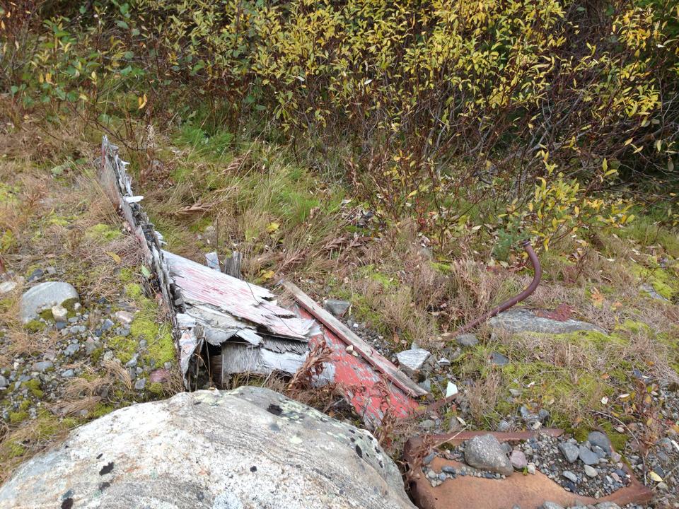
Then we have the mystery building, culvert, storage nook, or bunker.  Whatever you call it, it has a couple of vents, what looks like a plywood door.  Any suggestions as to what the structure's original purpose was would be welcomed!  I was thinking explosives storage.

Photo: PL Tremblay


Photo: PL Tremblay
  
Photo: PL Tremblay


Photo: PL Tremblay


Schefferville


Site Name: Schefferville
Location: Near Schefferville, QC
Built: 1957-1958
Operational: Unknown
Coordinates: Near 54.8143, -66.7544 (023J15)
Lot/Concession:
Condition:
Current Ownership: Unknown
Distance from paved road: Unknown
Condition of access road: Unknown

It is documented that a troposcatter site was at Schefferville, however I don't know where.  Looking around using recent satellite imagery I haven't been able to locate any traces of billboard antennas.  I haven't found any vintage pictures of troposcatter antennas either.


View Larger Map


Canatiche

Canatiche, Summer 1973
Photo Credit: Robert Smith O'Ghobhain

Site Name: Canatish, QC
Location: Near Canatish Lake, QC
Built: 1957-1958
Operational: Unknown
Coordinates: 51.249369, -65.606836 (022P04)
Lot/Concession:
Condition: Partially Remediated
Current Ownership: Unknown
Distance from paved road: Unknown
Condition of access road: Unknown

Canatish was positioned between Trouble Mountain and Emeril to act as a repeater.  Today the location is not realistically road-accessible, and can only be reached by rail, helicopter, or maybe float plane.  The ruins of the site are clearly visible with satellite imagery.  The footings of the billboard antennas and foundation of the main building are clear.


View Larger Map

atlas.gc.ca
1983 Topographic Map 1:50000 Scale


Trouble Mountain


Site Name: Trouble Mountain
Location: Trouble Mountain, QC
Built: 1957-1958
Operational: 1958-
Coordinates: 50.172400, -66.737427 (022J02)
Lot/Concession:
Condition: Repurposed
Current Ownership: Private
Distance from paved road: 
Condition of access road: Good

Trouble Mountain is cited as the last tropo hop in the network; from here terrestrial microwave would be used to tie in with the usual telecom network.  I am not sure if this is the exact site of the tropo billboard antennas, but I think I see footings NE of the building.  The oldest topographic map I could find (Published in 1979, made with 1976-77 air photos) also happens to show "microwave" antennas at the same location as those billboard antennas should have been... coincidence?


atlas.gc.ca
1979 Topographic Map showing two microwave towers at the suspected location of the Trouble Mountain Tropo site


Pictures:

I was very pleased to find this testimony and these pictures from Robert Smith Ghobhain.
In reading of the Abel Danger Chicago's Candyman and Her Short for Snuff Swaps - Chapter 8, I see of the Thiokol snow-cat, and this bring back memories of 1973-74 when I be at Canatiche in Northern Quebec and at Emeril and Cartwright in Labrador. I was stationed at these places as a radio technician for Bell Telephone and then later for Newfoundland Telephone maintaining the South Polevault Scatter Radio system.

There were five people stationed at Emeril and Cartwright site with a supervisor, two technicians, a cook, and a diesel mechanic , and four at Canatiche with two technicians, a cook, and a diesel mechanic.
Canatiche station was about 3,000 feet up, Emeril station about 2,000 feet up, and Cartwright station about 500 feet up. Cartwright had a small fishing village down below on the bay.

Maybe I am in a different time place, and I have moved, or maybe the others have moved. But, still I have the pictures to show that I was really at these places.

The two years I spent in Northern Quebec and Labrador was a good education for me of how other people lived, and that the black flies and the mosquitoes thrive very well there. They really like the smell of any deodorant and the perfumed fragrance.

Cartwright station was a good place to be, as there be more people around. The people from the fishing village would come up to the site to visit. Even the mounties stationed at the village would come up to visit. The site still retained the 'comforts' of the former facilities of the Sargeants Mess from the U.S Air-Force.

Canatiche and Emeril stations were not the easiest places to be. As they be more isolated, access by helicopter. There be the Quebec & North Shore Railway that stopped at mile 84 and at mile 227, only if their be anybody getting on or off at the valley below. This how we got most of our supplies, by the train.

Robert Smith O'Ghobhain
Sarnia, Ontario
January 7th, 2013
Original Post: http://www.rumormillnews.com/cgi-bin/archive.cgi?noframes%3Bread=265569
Canatiche, Summer 1973
Photo Credit: Robert Smith Ghobhain

Canatiche Winter 1972-1973
Photo Credit: Robert Smith Ghobhain

Cartwright Winter 1973-1974
Photo Credit: Robert Smith Ghobhain

Cartwright Winter 1973-1974
Photo Credit: Robert Smith Ghobhain

Emeril Winter 1972-1973
Photo Credit: Robert Smith Ghobhain

Emeril Winter 1972-1973
Photo Credit: Robert Smith Ghobhain

Trackmaster @ Cartwright, Winter 1973-1974
Photo Credit: Robert Smith Ghobhain


Credit: IEEE Spectrum September 1966 p.79-100

Credit: IEEE Spectrum September 1966 p.79-100
Credit:

A big thank you to Alex Lupták who contributed to this post!

References:

The News and Eastern Townships Advocate, April 24th 1958 (Page 20)
http://news.google.com/newspapers?id=koQuAAAAIBAJ&sjid=syoDAAAAIBAJ&pg=1887%2C5201029

The Daily News St John's, Wednesday December 3rd, 1958 (Page 4)
http://collections.mun.ca/daily_news_pdfs/1958/12/19581203.pdf

March 08, 2014

1970 Hydro-Québec Eric / Logan troposcatter link

Site Name: Eric?
Location: Poste Montagnais Hydro-Québec / Eric
Built: ~1970
Operational: Unknown
Coordinates: 51.98483, -65.6545
Lot/Concession:
Condition: Active (Last info as of 2008)
Current Ownership: Hydro-Québec
Distance from paved road: Unknown, area is unreachable by road
Condition of access road: Unpaved road leads from rail line to tropo site

Site Name: Logan?
Location: Churchill Falls, Québec
Built: ~1970
Operational: Unknown
Coordinates: 53.5879, -64.2012
Lot/Concession:
Condition: Active (Last info as of 2008)
Current Ownership: Hydro-Québec
Distance from paved road: 1 Km from main road, not sure if the 500 is paved at that point.
Condition of access road: 1 Km access road of unknown condition, expected to be passable but gated as the site is active

Overview/Background:

While researching the communications link between Goose Bay and NORAD/SAC facilities further south, I found reference (thanks to Alex Lupták) of a whole world of troposcatter facilities (http://rammstein.dfmk.hu/~s200/tropo/Tropo.kmz).  I mistook the currently operational Hydro-Québec troposcatter sites "Eric" and "Logan" to be old Cold War facilities that had been repurposed... now, I don't know that's entirely untrue, since there was a 6 site (5 hop) troposcatter network that joined Québec and Labrador built in the 1950s and potentially decommissioned around the same time as the Logan-Eric link was made... but let's say it was purely coincidental that Eric-Logan used seemingly identical antennas and technology.

With a little help from Google, I found the following from the Utilities Telecom Council of Canada:
"Hydro-Quebec reported that they intend to continue to operate one troposcatter hop in Labrador, which is above 200 kilometers and operates currently in the 1.7-1.9 Ghz band.  While Hydro-Quebec expects to replace this hop within the next five years, it needs to continue to use it for the foreseeable future because it has not found any other equipment in another band that could be used."
Correspondence between Utilities Telecom Council of Canada and the Director of Spectrum Engineering Branch of Industry Canada (2008.07.25)
http://www.utccanada.org/sites/default/files/public/UTC_Public_files/UTCC%20Comments%20on%20SMSE-018-12.pdf
Rail Map of the Tshiuetin Rail route
(click to enlarge)
Extrapolating from the information in that correspondance, I believe it stated that the link between Eric and Logan is a 60 channel analog link.  Eric to Logan is just over 200Km, matching the description, and it's only one hop.  They do mention that there is a two-hop troposcatter link used by Hydro-Québec somewhere, and I'm not sure where yet. 

So why is this important?  Why care?  Why is this so interesting?  Well, troposcatter sites of this design were used along the Mid-Canada line at Site 070, 060, 050, 415 and 410 - which were all shut down in 1967.  Other sites, like the troposcatter link that went from Hay River to Lady Franklin Point for DEW Line communications were decommissioned by the military in the 1970s.  The White Alice network along the West Coast up to Alaska was decommissioned many years ago as well.  Polevault along the East coast?  Long gone.  To the best of my knowledge Eric and Logan are essentially the same as those other troposcatter facilities, making them living museum pieces (as much as Hydro-Québec might cringe from me calling them that).


Directions:

Regarding getting to Eric;
I'm not really sure there's a GMC Suburban-passable road to Eric from Sept-Isles, so it seems the only way to get there is by train.  Not VIA, they don't go that far, it's Tshiuetin Rail Transportation (wikipedia here, web site here)  The train from Sept-Isles leaves at 8am Monday and Thursdays, and Eric is half a day's train ride away.

I get the feeling that walking up to a remote critical infrastructure building, in the middle of nowhere, with a fence, would be a bad idea; so I'm going to have to ask around and see if I can find someone with an interest in the history of this site within Hydro Quebec.  Also, I'd rather see the inside of the facility than just the outside.  Now that would be a trick.  Wish me luck.


Logan is right off HWY500, the trans-Labrador Highway

Trip Report:

Haven't been, yet...


Maps:


Eric Troposcatter Antenna Site (pointing at Logan, 200Km NNW)


Eric Troposcatter Antenna Site
(There is a road that leads West to, and along, the rail line)
atlas.gc.ca 1:30000


Logan Troposcatter Antenna Site
atlas.gc.ca 1:15000


Reference:

L'Avenir Page 16 - May 9th, 1972 (Thanks to Alex Lupták - and Google News too)


February 17, 2014

1958 Kenora - Red Lake Ontario Tropo

Reviewing the information in the September 1966 edition of IEEE Spectrum has opened my eyes to several previously unknown-to-me troposcatter links which were in use, in Canada, during the Cold War timeframe.  Many of these networks were not specifically military, but used similar (sometimes identical) gear to the military, and may have had satellite civil defence or safety benefit by connecting remote towns with more reliable communications.  The authors of the article I'm referencing gathered their information from trades articles of the time and other open source information.  Some of the information may be incorrect, but while most of the information seems factual, some doesn't make sense.

AN/TRC-90?

http://www.mobileradar.org/Documents/other_equip/photos_drwgs/radios/TRC-.jpg
Take the Kenora Ontario to Red Lake Ontario tropo link.  It was built ~1958.  It had only 4 voice channels, expandable to (only) 12.  It was built by Collins Radio Co using Colins gear from top to bottom - including (2?) the 15 foot Collins reflectors.  It's output was 1kW, and it shot 91 Miles.  It was listed as being both fixed, *and* transportable.  It used the 900Mhz band.  It was listed as "CC" Common Carrier - so, maybe for phone use?  Was it for one of the mines or private industry who wanted to be able to communicate South in case of emergency?  Four phone lines doesn't seem like much for a phone company, and a 15 foot reflector is a small satellite dish compared to the 100ft+ billboards in use elsewhere.  I have many more questions than answers. Where were these located?  Who purchased them, and for what?

Collins pitched (successfully) the AN/TRC-90 1kW 15ft antenna tropo kit to the American military, and were deployed to Vietnam in 1963.  Was this 15ft 1kW rig a test, or part of the Collins development cycle? Maybe not, but it is interesting that the military kit is transportable and has the same sized reflector.


1960 Snow Lake to Thompson Manitoba Tropo Link

This is what a 28' D S Kennedy Parabolic antenna looks like.
http://www.nitehawk.com/rasmit/ras_pics.html
Back in 1960, a troposcatter communication link was set up between the town of Snow Lake and the City of Thompson.  The two locations are separated by 105-120 miles, and other than their names on the below map from the 1966 edition of the IEEE Spectrum publication; I have no idea where the tropo antennas located at either place were.  From the information below, they would have been a pair of D S Kennedy 28 Foot parabolic antennas at either end, have been built by RCA ~1960, and supported 30 voice channels.  The tropo link was listed as "Common carrier", suggesting it wasn't a military communications link (however, the Hay River / Lady Franklin Point link is also listed as Common Carrier, and it is well known to have been dual use).  On the map below this tropo link is shown as #39.


Because both areas have heavy industry, there are a lot of power lines, roads, rail, and other scars to the landscape that make my usual tricks (like following gaps in the tree line) ineffective at finding the site.  Even after 50 years of growth, a trail in the forrest is still usually visible if a road has gone into disuse - but there are too many dead ends around these areas.

Chisel Lake, Osborne Lake, and Herb Lake are other towns near Snow Lake - but I've found the closest reference point is always used to name these sites, so I'm betting the tropo antennas are closer to Snow Lake than the rest of the surrounding towns.  Unfortunately, I still don't know exactly where.

Different vantage point of a 28' D S Kennedy Parabolic
http://www.k5so.com/Objectives.html
I've checked Google Maps, Bing Maps, Toporama, and leafed through other maps available via GeoGratis.  No luck.  So, I'll just leave this here as an unsolved mystery and come back to it later.


January 25, 2014

Galena to Arctic Red River Troposcatter Link

Canadian National Telegraphs (Canadian National Telegraph Co? / CNT) served the telecommunications needs of Canada's Western Arctic before it was merged in the 1970 with Northwest Telecommunications, now NorthwesTel.  In 1963 they were awarded the contract to provide the telecom backbone which would link DEW Line sites with command and control in the South.

Originally I thought these North-South troposcatter links were built by the military, but it turns out they were contracted to corporations (CNT in this case), mostly funded by the military, but other services (like long distance telephone) rode on their coat-tails, and local communities (arguably) benefited.

From what little documentation I could find, the troposcatter link between Galena Hill and Arctic Red River was one "hop", unlike the Hay River / Lady Franklin Point three hop link.  I would guess the rest of the way was by LOS Microwave(?).

Unfortunately, the satellite imagery I've been able to find is rather sub-par, and I cannot positively identify where the Galena Hill site is.  There are several mines in the area, so I'm uncertain what is mine-related or troposcatter facility related on the fuzzy imagery.  I believe the troposcatter antennas would have been near the NE end of Galena Hill between Elsa and Keno, since the giant "billboard" antennas had to point NNE toward Arctic Red River. The signal was being transmitted as a ~400Km skip off the troposphere, so the angle of the antenna would have been very shallow to the horizon.

View from Keno Hill, near Galena Hill
Courtesy of Branko Balaz
Original: http://www.mindat.org/photo-269114.html


(From the Keno Mining Museum)
Courtesy of Branko Balaz
Original: http://www.mindat.org/photo-269109.html

Galena Hill Troposcatter Site (somewhere around there)

View Larger Map


At the other end of this troposcatter hop is Arctic Red River, now known as Tsiigehtchic. The imagery from that end is much better than the Galena Hill area.

Arctic Red River Troposcatter Site (67.41662, -133.60986)


View Larger Map


Putting it all together here is a map of the two sites and the link between them.


January 01, 2014

DEW Line - Hay River to Lady Franklin Point troposcatter link

I don't spend a lot of time researching the DEW Line, but the Hay River troposcatter link between Hay River and Lady Franklin Point caught my eye. In 1960 CNT (Canadian Telecomms Company) built the link for the US Military to run DEW line comms over it, and piggy-backed civilian phone service over it as well.  Sometime after the DEW line was decommissioned, and this antiquated link to northern communities was no longer needed, it was sold to private interests... well, here's the whole story:

Hay River’s parabolic antenna turns 50 this year
(Published February 4, 2013)
Hay River Troposcatter Antenna
Photo Credit: Adventure Caravans
http://ahome4u.net/nwt/day%2020.html
Regardless of whether you go by Robert Dean’s property on Vale Island by land or water, you can’t help but be drawn to the enormous dish that points to the sky.Its unorthodox appearance and location has probably confounded hundreds of people throughout the years.


“When I was a child, I thought it was a drive-in movie screen for boats,” said Hay Riverite Kate Latour.

In fact, the 60-foot billboard shaped antennas were part of the Cold War’s Distant Early Warning System (DEW Line), built in 1963 along with other radar equipment to monitor Soviet bombers and prevent land and water invasions in the Arctic.

The antenna would transmit and receive signals by tropospheric scatter, a method of bouncing microwave signals off the troposphere – the lowest portion of Earth’s atmosphere – and then having them picked up by receiver stations as far away as the signal scatters.

Around 1975, when the Canadian military stopped using the facility, it was operated by Canadian National Telecommunications (CNT), a subsidiary of Canadian National Railways, and turned into a way to communicate with northern sites.

Poul Osted’s aunt worked as a phone operator at the facility.
Hay River Troposcatter Antenna
Photo Credit: Adventure Caravans
http://ahome4u.net/nwt/day%2020.html

“Back then, this was as far north as the phone lines came,” he said. “The signals received by the antenna would be sent out via telephone lines to receiver stations down south. Then they were used for civilian purposes and every time a person would call the site to be connected elsewhere, everyone on the line could hear the conversation, just like on a CB radio.”

At that time, a young Northwestel employee by the name of Robert Stephens discovered the facility, and spent some time there on a microwave technician training course while it was still being operated by CNT.

In the early ’80s, Stephens was living in Edmonton and began searching for equipment he could use to establish a dedicated Search for Extraterrestrial Intelligence (SETI) program.

When he came back to Hay River in 1981 and discovered that the site had been decommissioned, he was able to purchase the antennas for the relatively low cost of a dollar, according to his website.

“Before I could remove the antennas for relocation to a site in Alberta, CNT decided to sell the property by auction,” Stephens said in a recent e-mail.

He said he pleaded his case before town council in 1983, laying out his plans to establish a radio observatory at the site. His motives were backed by extensive research in the form of a 23,000-word report, concluding that the site was a suitable location for his project.

With very limited funds, he made the highest bid he could without borrowing any money. The town also entered a bid to secure the site for the proposed radio observatory.

The eight-acre property was put on the block in 1985 and was purchased by Robert Dean, who came out on top with a bid under $20,000.

As a result, Dean and Stephens negotiated a five-year lease agreement. After selling off most of his personal possessions in order to buy various pieces of equipment, Stephens was finally able to start monitoring the skies for extraterrestrial signals.

From 1985 to 1989, his work gained international attention. The American television network NBC even sent a news crew to the site in 1987 to do a story on it. The same year, Stephens hosted his first undergraduate university student, who came to the site for some hands-on observing experience.

A July 1987 Hub article described a campaign drive, in which he travelled across Canada and the United States to drum up support for his project. It also documents his mounting debt, which stood at $50,000 at the time.

Without a constant source of funding, Stephens had no way of paying his property-lease payments and mounting utility bills. In 1989, he was forced to abandon his project and leave Hay River altogether, and now lives in Ontario.

Dean tore down one of the antennas, to Stephens’ dismay, and left another standing, because “it was kind of a landmark,” he said.

“Years later, I found out Dean had torn down one of the dishes after I’d left,” Stephens said. “My use of the site as an astronomical radio observatory was completely harmonious with the existence of the structures as a navigational aid for fishermen and the bit of tourist interest that my repurposing the site had created.”

Reached last week in Arizona, Dean said he still didn’t have any plans for the last remaining dish.

“It’s a real curiosity piece,” he said, adding tourists drop by once in a while to ask him questions about it.

In a 2001 News/North story, he mentioned his desire would be for an artist to come by and paint a giant mural on the dish’s smooth surface.

– Myle Dolphin
http://www.hayriverhub.com/2013/02/hay-rivers-parabolic-antenna-turns-50-this-year/
Furthermore
"In 1960 Canadian National Telecommunications installed a tropospheric scatterwave (troposcatter) system to link up with Distant Early Warning (DEW) line stations in Canada's north. This was also a United States Department of Defence contract. It also, in the process, improved civilian communications in the North. Technology and the commercial market had finally advanced to the point where the provision of commercial communications for Canada's north had become viable. For the military this marked the milestone where it went from the provider of communications to the customer." http://www.c-and-e-museum.org/chap6_e2.htm
 

Location of Hay River Troposcatter Antennas
atlas.gc.ca


View Larger Map


I believe Snare Rapids is next hop, and it is also the site of a hydro electric dam.  I cannot find any imagery of the troposcatter antennas, or exact location of the antennas.


View Larger Map


Port Radium has excellent satellite imagery on Google Maps, which clearly shows the ruins of the troposcatter antennas - two pointing South and two pointing North.


View Larger Map


Lady Franklin Point is a sprawling unmanned military facility, and no specific location can be pinpointed by today's satellite imagery showing where the troposcatter antennas were.