Background:
I'm interested in pinpointing the exact locations of each of the sites involved in the Bell troposcatter network built between Goose Bay and Sept-Îles betwen 1957-1958. Using information from the September 1966 IEEE Xplore publication, periodicals of the time, and some help, I think I've nailed down more or less where the sites were. It helped that the newspaper articles of the time mentioned the names of the locations for me! The illustration below from the IEEE shows the general layout of the sites (along the line marked "10")
In 1958 Bell Telephone Co. of Canada made a radio network using troposheric scatter (troposcatter) comprised of 5 "spans" (hops) between 6 points on the map ranging in distance between 80 miles to 150 miles apart. This was to relay military as well as civilian communications from Labrador to Sept-Îles, where terrestrial microwave and then land lines would be available to take the communications the rest of the way. These are the same style of troposcatter billboard antennas as were used for the Mid-Canada Line connection to Mount Kempis, which was also built by Bell; so they were basically built to the same specification, by the same people.
I've illustrated the sites on Google Maps (above) to show where I believe the general or specific locations of the troposcatter antennas were based on information, some deductive reasoning, and some help from Alex Lupták.
Melville Air Station (Melville AS)
 |
| Melville AS Bell Troposheric Scatter Site Photo Courtesy of Pinetreeline.org Exact Photo Credit TBD |
Site Name: Melville Air Station (Melville AS)
Location: Goose Bay, NL
Built: 1957-1958
Operational: Unknown
Coordinates: 53.29448, -60.54243 (013F07)
Lot/Concession:
Condition: Remediated
Current Ownership: Unknown
Distance from paved road: Unknown
Condition of access road: Unknown
Melville Air Station (near Goose Bay) has been remediated, but where the antennas were located is easy enough to figure out by using vintage pictures. The distance between Melville and Sona Lake is ~150 miles, the distance we're told in the IEEE publication was the longest "hop" in the network.
 |
| Melville Air Station Bell Troposcatter Antenna Location atlas.gc.ca |
View Larger Map
Sona Lake
Site Name: Sona Lake
Location: Near Churchill Falls
Built: 1957-1958
Operational: Unknown
Coordinates: 53.5640, -63.8454 (023H09)
Lot/Concession: Unknown Condition: Partially Remediated
Current Ownership: Unknown
Distance from paved road: Unknown
Condition of access road: Poor
The Sona Lake site would have been a troposcatter repeater between Melville and Emeril. Bing satellite imagery shows a flat spot at the end of a trail to the top of Sona Hill. From comments on the blog, help from PL Tremblay, and thanks to the the Nalcor and Hydro Quebec guys locally, this is where I believe the Sona Lake was located. The height is right, the site should provide a view to both Emeril to the West and Melville to the East. Power for this site would likely have been provided by on-site Diesel generators since there wasn't much of a power grid in that area in the late 1950s.
Emeril
 |
| Emeril(?) Winter 1972-1973 Photo Credit: Robert Smith Ghobhain |
Location: Near Ross Bay Junction, Labrador
Built: 1957-1958
Operational: Unknown
Coordinates: 53.13405, -66.0895 (023G01 1990 Ed)
Lot/Concession:
Condition: Re-purposed site
Current Ownership: Unknown
Distance from paved road: 2Km
Condition of access road: Good
Somewhere around Emeril (Labrador) a troposcatter repeater comprised of four or six billboard antennas pointed in two or three different directions was erected. According to Alex Lupták's keen eye, it looks like the site was quite a bit East of Ross Bay Junction; but I'm not sure all six billboard antennas were at the same site, or if some of these were between the rail and the airstrip at the top of another hill to the west. A trip to the air photo library is needed.
From PL Tremblay's trip to the site at the end of September, clearly the foundations are still there, but the overall site has been repurposed.
 |
| Emeril Station foundation? Photo: PL Tremblay |
 |
| Emeril Station foundation? Photo: PL Tremblay |
 |
| Emeril Station foundation? Photo: PL Tremblay |
 |
| Emeril Station foundation? Photo: PL Tremblay |
 |
| Emeril Station foundation? Photo: PL Tremblay |
 |
| Original part of Emeril Station? Photo: PL Tremblay |
 |
| Original part of Emeril Station? Photo: PL Tremblay |
 |
| Original footing from a tropo antennas at Emeril Station? Photo: PL Tremblay |
 |
| Original footings from a tropo antenna at Emeril Station? Photo: PL Tremblay |
 |
| Photo: PL Tremblay |
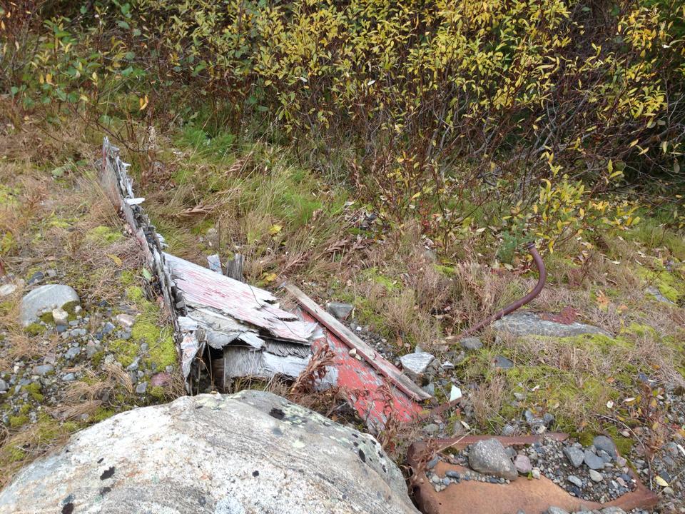
Then we have the mystery building, culvert, storage nook, or bunker. Whatever you call it, it has a couple of vents, what looks like a plywood door. Any suggestions as to what the structure's original purpose was would be welcomed! I was thinking explosives storage.
 |
| Photo: PL Tremblay |
 |
| Photo: PL Tremblay |
 |
| Photo: PL Tremblay |
 |
| Photo: PL Tremblay |
Schefferville
Site Name: Schefferville
Location: Near Schefferville, QC
Built: 1957-1958
Operational: Unknown
Coordinates: Near 54.8143, -66.7544 (023J15)
Lot/Concession:
Condition:
Current Ownership: Unknown
Distance from paved road: Unknown
Condition of access road: Unknown
It is documented that a troposcatter site was at Schefferville, however I don't know where. Looking around using recent satellite imagery I haven't been able to locate any traces of billboard antennas. I haven't found any vintage pictures of troposcatter antennas either.
View Larger Map
Canatiche
 |
| Canatiche, Summer 1973 Photo Credit: Robert Smith O'Ghobhain |
Site Name: Canatish, QC
Location: Near Canatish Lake, QC
Built: 1957-1958
Operational: Unknown
Coordinates: 51.249369, -65.606836 (022P04)
Lot/Concession:
Condition: Partially Remediated
Current Ownership: Unknown
Distance from paved road: Unknown
Condition of access road: Unknown
Canatish was positioned between Trouble Mountain and Emeril to act as a repeater. Today the location is not realistically road-accessible, and can only be reached by rail, helicopter, or maybe float plane. The ruins of the site are clearly visible with satellite imagery. The footings of the billboard antennas and foundation of the main building are clear.
View Larger Map
 |
| atlas.gc.ca 1983 Topographic Map 1:50000 Scale |
Trouble Mountain
Site Name: Trouble Mountain
Location: Trouble Mountain, QC
Built: 1957-1958
Operational: 1958-
Coordinates: 50.172400, -66.737427 (022J02)
Lot/Concession:
Condition: Repurposed
Current Ownership: Private
Distance from paved road:
Condition of access road: Good
Trouble Mountain is cited as the last tropo hop in the network; from here terrestrial microwave would be used to tie in with the usual telecom network. I am not sure if this is the exact site of the tropo billboard antennas, but I think I see footings NE of the building. The oldest topographic map I could find (Published in 1979, made with 1976-77 air photos) also happens to show "microwave" antennas at the same location as those billboard antennas should have been... coincidence?
 |
| atlas.gc.ca 1979 Topographic Map showing two microwave towers at the suspected location of the Trouble Mountain Tropo site |
Pictures:
I was very pleased to find this testimony and these pictures from Robert Smith Ghobhain.
In reading of the Abel Danger Chicago's Candyman and Her Short for Snuff Swaps - Chapter 8, I see of the Thiokol snow-cat, and this bring back memories of 1973-74 when I be at Canatiche in Northern Quebec and at Emeril and Cartwright in Labrador. I was stationed at these places as a radio technician for Bell Telephone and then later for Newfoundland Telephone maintaining the South Polevault Scatter Radio system.
There were five people stationed at Emeril and Cartwright site with a supervisor, two technicians, a cook, and a diesel mechanic , and four at Canatiche with two technicians, a cook, and a diesel mechanic.
Canatiche station was about 3,000 feet up, Emeril station about 2,000 feet up, and Cartwright station about 500 feet up. Cartwright had a small fishing village down below on the bay.
Maybe I am in a different time place, and I have moved, or maybe the others have moved. But, still I have the pictures to show that I was really at these places.
The two years I spent in Northern Quebec and Labrador was a good education for me of how other people lived, and that the black flies and the mosquitoes thrive very well there. They really like the smell of any deodorant and the perfumed fragrance.
Cartwright station was a good place to be, as there be more people around. The people from the fishing village would come up to the site to visit. Even the mounties stationed at the village would come up to visit. The site still retained the 'comforts' of the former facilities of the Sargeants Mess from the U.S Air-Force.
Canatiche and Emeril stations were not the easiest places to be. As they be more isolated, access by helicopter. There be the Quebec & North Shore Railway that stopped at mile 84 and at mile 227, only if their be anybody getting on or off at the valley below. This how we got most of our supplies, by the train.
Robert Smith O'Ghobhain
Sarnia, Ontario
January 7th, 2013
Original Post: http://www.rumormillnews.com/cgi-bin/archive.cgi?noframes%3Bread=265569
|
| Canatiche, Summer 1973 Photo Credit: Robert Smith Ghobhain |
 |
| Canatiche Winter 1972-1973 Photo Credit: Robert Smith Ghobhain |
 |
| Cartwright Winter 1973-1974 Photo Credit: Robert Smith Ghobhain |
 |
| Cartwright Winter 1973-1974 Photo Credit: Robert Smith Ghobhain |
|
| Emeril Winter 1972-1973 Photo Credit: Robert Smith Ghobhain |
 |
| Emeril Winter 1972-1973 Photo Credit: Robert Smith Ghobhain |
 |
| Trackmaster @ Cartwright, Winter 1973-1974 Photo Credit: Robert Smith Ghobhain |
 |
| Credit: IEEE Spectrum September 1966 p.79-100 |
 |
| Credit: IEEE Spectrum September 1966 p.79-100 |
A big thank you to Alex Lupták who contributed to this post!
References:
 |
| The News and Eastern Townships Advocate, April 24th 1958 (Page 20) http://news.google.com/newspapers?id=koQuAAAAIBAJ&sjid=syoDAAAAIBAJ&pg=1887%2C5201029 |
.png) |
| The Daily News St John's, Wednesday December 3rd, 1958 (Page 4) http://collections.mun.ca/daily_news_pdfs/1958/12/19581203.pdf |
I was stationed at Emeril in late 1963 to 1964. I have pictures....here is my Email tonyw@hurontel.on.ca
ReplyDeleteI was in Emeril and Canatiche in 1966 and 1967. To answer a couple questions i've been reading.
DeleteEmeril had 6 x 45' antennas .. Two pointing south to Canatiche, two east to Sona Lake and two north to Schefferville (Knob Lake. Sometime in 1966 we shut down Schefferville so quite possible by 1972 those two antennas may have ben removed.
The mysterious bunker we were told was meant as a fall out shelter in the event of a nuclear attack. Obviously with its plywood entrance it was never finished.
So interesting reading all these posts and travelling back in time.
John Hurd, Brossard, QC. Originally from the Sherbrooke area.
ja.hurd@sympatico.ca
I was stationed for 6 months at each site, Sona Lake and Emeril from 1977 to 1978 as a technician. Got my start in electronics. Would love to see the old sites again. Can't believe 36 years have passed. My email: davjanes@telus.net
ReplyDeleteI had the opportunity to work in Goose Bay (for a month) , Sona Lake (for 10+ months) and Schefferville (for approx 1 month) tropo scatter sites with Bell Canada as a 22 yr old ..radio tech from 1962-63... before returning to London Ontario...GREAT experience.. fantastic country..still remember 9 months of snow and winds in excess of 50 mph (old days)and and -40 degrees F (same old days) .Sona Lake was frozen over by end of October in '62 and the Ice cleared off end of June/early July '63...No road access or hydro grid in the area...only access was by air, weather permitting, normally from Goose bay..occasionally from schefferville or Sept isle ...had I been single when I went there, doubt if I would have ever left.. now retired from BC Tel and living in NW British Columbia
DeleteHi Dave: I was a friend of your sister Peggy and after you my brother-in-law Steve spent time in Sona Lake. Do you know of anyone interested in a set of three emergency Western Electric battery operated phones from that site? They are cast iron and in good condition for their age. Very heavy!
DeleteDiane, I would be interested in a set if there is one still there!
DeleteDAVE MCNEICE/Anonymous
ReplyDeleteWe're trying to identify a site on a hill right at the top of Churchill Falls Town. Think you can help us out?
https://www.google.ca/maps/place/53%C2%B032'14.3%22N+64%C2%B000'34.6%22W/@53.537306,-64.0117957,691m/data=!3m2!1e3!4b1!4m5!3m4!1s0x0:0x0!8m2!3d53.537306!4d-64.009607
Email agale@verticalspec.ca if you want to discuss more.
Just got back from the Emeril Site, this weekend. Got some current 360 Photos, and alot of questions. Does anyone have pictures of the site when it was still in operation?
ReplyDeleteI only have the ones above I pinched from Robert Smith Ghobhain
DeleteYou leaving me hanging re: the pics? :)
LOL no worries. We were more interested in why a Civilian installation would have a fortified bunker. It's not listed, but was this site part of DEW Line, or Pinetree Line?
DeleteLet me know if this link doesn't work.
https://www.facebook.com/media/set/?set=a.10159286561085717.1073741847.624715716&type=1&l=8eea2ad80d
360 Video
https://youtu.be/BZ91wroCBng
I worked at the Canatiche site in 1965/66. I worked out of the Montreal Toll District during my stint with Bell Canada from 1963 thru 1970. I dare say it could get quite chilly in the winter. I also remember the hijinks we played on each other when a rookie came to the site.The good old days
ReplyDeleteBell Canada Speed Test
ReplyDeleteSounds like Ron BEGLEY
ReplyDelete