Between October 14th and October 18th I was fortunate enough to take a trip into Northern (Northeastern) Ontario to see a few Cold War (and Cold-War Adjacent) sites that were on my bucket list, and was lucky enough to have a travelling companion who was excited to see some of same places as well. Thank you RH for coming! We covered over 2,700 km in four days; saw many things, missed some things, took pictures at roadside attractions, didn't die, but the weather didn't really cooperate. On the other hand, the weather could have been worse, so I shouldn't really complain!
 (North Bay, Ontario)
On the first night we decided to hit a Motel; it had been raining pretty steadily all day. Just down the road from the North Bay BOMARC launch facility we found the Bo-Mark Motel... see what they did there? Naturally, we had to stay there. From the outside, the Motel looked a little dated, but it was extremely well cared for inside, looks like it has been renovated, and was very clean. I was impressed. I would recommend it to any weary travelers. They were full by 11pm, so be early! As it turns out, the dog loves sleeping in the truck, and hates sleeping in a motel, so I ended up sleeping in the back of the Suburban with the dog so he didn’t bark all night - it's quite comfortable back there!
I was very pleased to finally see the Canadian Forces Museum of Aerospace Defence in North Bay. Their dedicated staff have the support of the Canadian Forces and understand the value of preserving the CF's rich air defence history. The museum has recently been renovated and has exhibits dating back to WWI; of course, my interest is mainly focused around the Cold War, and I was both thrilled and impressed with the quantity and quality of the materials at the exhibit. The staff of the museum are extremely knowledgeable and passionate about their work, you will not be disappointed. If you are passing through North Bay and have an interest in Canadian Air Defence, you should really stop in. Check their web site for hours www.aerospacedefence.ca
What about the underground bunker? Unfortunately there are currently no tours of the former headquarters underground, it is currently being demilitarized and stripped of all military equipment. Very unfortunate. Considering how excited I get to see a bare patch of land where a base once stood, I really don’t care that there isn't anything "down in the hole", I don't need a museum down there, I don't even need a formal tour; just open the door!
The administration of the Jack Garland Airport in North Bay astounded me by proving escorted access inside the wire to the Cold-War-era Quick Reaction Alert (QRA) hangers and former munitions storage facility within the grounds of what is now the Jack Garland Airport. Previously, in case you were not aware, the now-civilian airport was part of CFB North Bay. The airport's administration are well versed in the history of their airport and appreciate that individuals such as myself are interested in seeing what once would have been inaccessible to the public. I am very grateful they were so courteous and answered every question possible. Thanks to them, I was finally able to see the inside of a fairly unmodernised QRA hanger, and see the original three piece hanger doors which are often upgraded to "modern" doors as they break, due to the difficulty of repairing the originals. They also granted access to the munitions bunker, but I discovered three other people this year has also been knocking; also looking to see those buildings for their own curiosity, hobbies and perhaps business. If you are them, get in touch!
(North Bay, Ontario)
QRA hangers would have been built to keep all-weather interceptors (originally the Avro Canada CF-100 Canuck) fueled for take off, and have pilots stationed right next door in a small barracks building equipped with kitchen and sleeping facilities. The idea was to have the interceptors fully ready to take flight at a moment's notice. After initially being used for the CF-100, those same Cold-War-era QRA hangers have continued to be used for every generation of Canadian fighter jet since; even for Canada's latest CF-188 interceptors.
As it was explained to me; the hanger door was originally designed so that the two side doors would swing to the side, the middle door would lift (like a typical garage door), and the two supports would fold up and out of the way to opposite sides. This design, and having front and back doors open, allows planes to power up and fly right from the hanger, rather than being pulled out before starting up their engines. The doors are massive, and the counterweights and chains that are part of the mechanism are quite impressive too. I was told that the leftmost hanger (Northmost in the below picture) burned to the ground, and the pilot's barracks was essentially condemned and demolished years ago.
(North Bay, Ontario)
As I've mentioned previously; if there's a military airport, there has to be safe storage nearby to store any munitions that might fly in on said aircraft, and that storage needs to meet certain standards that correspond with the munitions that would be stored there. Property on the location of the former CFB North Bay aerodrome conforms to that theory with earthen-buried bunkers at the end of the runway. After the airport was split off from CFB North Bay in the 1990s, the bunkers were not demolished, but instead turned into storage for airport-related equipment. The bunkers are extremely reinforced, engineered to withstand the potential blast from their munitions going off, and buffer any shrapnel or blast from hitting the airport by diverting it upwards (if I understand the design properly). They show only minor cracks and rust, and are shockingly solid. All electrical conduits are airtight and to spec for environments where there could be explosives present; I've never seen anything like it!
We set up camp near the Fraserdale rail siding near the Abitibi Canyon dam.
Considering it was quite late when we set camp, it seemed like the best place we could find in the dark. Flat, dry-ish after a day of rain, and off the side of an access road by a rail siding. It was unlikely that anyone would be by, and it seemed safe enough. The next morning one of the locals who lived in Fraserdale stopped by to say Hi, as I'm sure we were a curious site. I was struck by how friendly everyone was on the trip. Fraserdale is certainly sparsely populated, but I didn't see any "scary" derelict housing (as I had expected). I used my camp stove in the morning to make MREs for breakfast, and made coffee before packing up and heading toward Relay, Ontario.
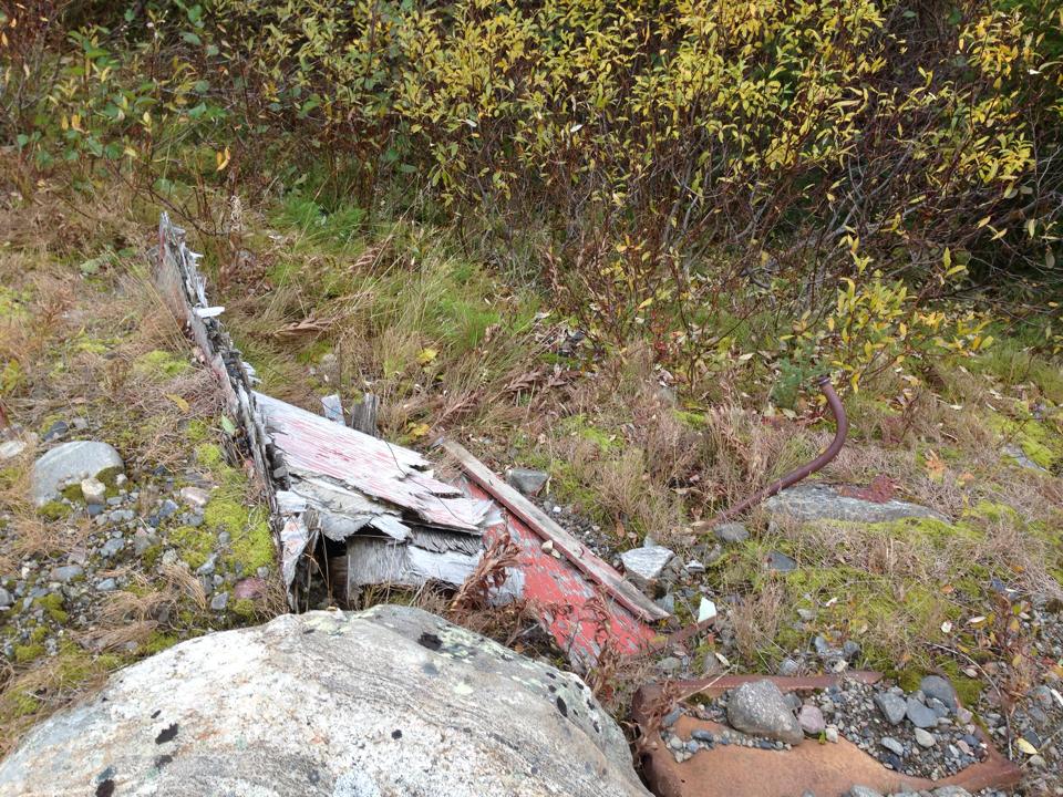
The MCL site at Relay was already cleaned up, so, except for one pad of concrete and a couple of chopped off telephone polls, there wasn't much... I was struck by how huge the area was that was remediated, and how there's absolutely no hint of the troposcatter antennas, buildings, or anything.
The road to get to the site was ~5km long, and easily walkable within an hour. What seem to be drainage ditched have been cut into the road, and mesh fastened to the ground presumably to prevent erosion. These ditches, while inconvenient, were not hard to jump over, and we did not get too wet. One of the ditches has been dammed by a beaver on the West side, making quite the lake on the West side of the road, and covering the road with water.
Prior to taking the trip, using the latest Bing Satellite imagery, I was able to see a path existed on the West side of the Abitibi, but I couldn’t tell exactly how well maintained that road was. As it turns out, it's not terrible, but it was a little scary at times. The road does have mile-markers along the way to give you a hint that you're on the right track, and overall at every road juncture the most travelled road is the "right" road to take when travelling from Relay to Otter Rapids. I would not recommend this road for any car, it will bottom out and destroy the vehicle. A 4WD Jeep, truck or large SUV required to make it, IMHO.
Overcast skies put a damper on the photography, but the size and power of the water that is flowing through the dam is mind-boggling. I think this is somewhere more people should make the trip to see. If I understand correctly, a lot of Toronto's power comes from this generating station.
Unfortunately I did not get any response to my attempts to contact OPG, so I was unable to schedule a tour of the facility. While Hydro Quebec publicly offers free tours of many of their remote sites, I get the impression OPG doesn't feel any reason to do so. Thanks a lot, eh.

This part of the trip was a failure, partially due to using up all my testosterone and bravery on the segment between Relay and Otter Rapids earlier in the day, partially because we were running out of light, and the weather looked like it was going to suck even more than it had been. Let me explain.
The plan was to leave the main road (Otter Rapids Road / Green circle), travel along a trail to a spot that has a marked walking trail (Blue circle), and walk to the bottom of where the water from the falls comes out and is more calm; a 15 minute "hike".
However, along the way we found a large body of water on the trail, and I was concerned that I didn't have sufficient self recovery tools aboard to SS Suburban in case we got stuck or soaked something electrical. I wasn't sure of the depth or condition of the road under the water, so we decided not to go to New Post Falls that day. Also influencing the decision was I didn't know exactly how many km we were from the trail head. Further influencing the decision to turn back was the time of day, less than a half hour from sun down, and it was raining off and on. The gods were not smiling on us, so we turned back.
Now that I look at the trail on Bing's satellite imagery again, I can see the water hazard on the road just ahead of where we stopped the Suburban. Also in hindsight, I can see that the waterfall would have been ~6km ahead if we'd walked it from there. Good to know for next time.
Travelling back to the Abitibi Canyon Dam to cross over in the dark was quite easy on the exceptionally good unpaved road on the East side of the Abitibi River; completely unlike the road on the West side of the river we had taken earlier.
We made it back as far as Val Gagne that evening and got a room out of the rain. Jasper was initially very twitchy, as every noise in the Motel made him want to check and see what was what. Eventually he fell into a deep-enough sleep and let us sleep as well.
While I was apprehensive, since there is an Adult Entertainment establishment next door, the room was actually pretty comfortable, and the bathroom was nice enough (tho dated looking). Their coffee was absolutely terrible, but their breakfast was delicious - fantastic bacon, sausages and eggs won me over.
While there is really nothing left of the Kempis Mountain Troposcatter site
(per my previous blog entries) we did stop to see the view since it seemed appropriate; We'd been to the Air Defence Museum in North Bay, and the next hop in the network at Relay after all!
Every time I take a trip like this I learn a little more about how to make the next one better. As I chew on the experience I expect to make a list of ways I could have improved it... not to take away from the awesome time that I did have, but to say; what could I do better next time?
Bo-Mark Motel
On the first night we decided to hit a Motel; it had been raining pretty steadily all day. Just down the road from the North Bay BOMARC launch facility we found the Bo-Mark Motel... see what they did there? Naturally, we had to stay there. From the outside, the Motel looked a little dated, but it was extremely well cared for inside, looks like it has been renovated, and was very clean. I was impressed. I would recommend it to any weary travelers. They were full by 11pm, so be early! As it turns out, the dog loves sleeping in the truck, and hates sleeping in a motel, so I ended up sleeping in the back of the Suburban with the dog so he didn’t bark all night - it's quite comfortable back there!
Canadian Forces Museum of Aerospace Defence
(North Bay, Ontario)
 |
| This radar console was used by the SAGE system from 1963-1983; please note the cigarette lighter and ashtray in the unit |
 |
| Cockpit selfie in the CT-133 Silveratar aka "T-Bird" |
Here is the official video of the descent into "The Hole":
Jack Garland Airport (YYB)
(North Bay, Ontario) |
| ~10,000ft of runway capable of supporting any plane in the world. |
Former CFB North Bay Quick Reaction Alert (QRA) Hangers
(Jack Garland Airport (YYB))(North Bay, Ontario)
 |
| The inside of the right-most QRA Hanger |
As it was explained to me; the hanger door was originally designed so that the two side doors would swing to the side, the middle door would lift (like a typical garage door), and the two supports would fold up and out of the way to opposite sides. This design, and having front and back doors open, allows planes to power up and fly right from the hanger, rather than being pulled out before starting up their engines. The doors are massive, and the counterweights and chains that are part of the mechanism are quite impressive too. I was told that the leftmost hanger (Northmost in the below picture) burned to the ground, and the pilot's barracks was essentially condemned and demolished years ago.
Former CFB North Bay Munitions Storage Bunkers
(Jack Garland Airport (YYB))(North Bay, Ontario)
 |
| Munitions Storage Bunkers |
 |
| Reinforced blast shield |
Near Fraserdale, Ontario
We set up camp near the Fraserdale rail siding near the Abitibi Canyon dam.
 |
| Looking Eastward near Fraserdale |
Mid-Canada Line Site 060
(Relay, Ontario)The MCL site at Relay was already cleaned up, so, except for one pad of concrete and a couple of chopped off telephone polls, there wasn't much... I was struck by how huge the area was that was remediated, and how there's absolutely no hint of the troposcatter antennas, buildings, or anything.
The road to get to the site was ~5km long, and easily walkable within an hour. What seem to be drainage ditched have been cut into the road, and mesh fastened to the ground presumably to prevent erosion. These ditches, while inconvenient, were not hard to jump over, and we did not get too wet. One of the ditches has been dammed by a beaver on the West side, making quite the lake on the West side of the road, and covering the road with water.
 |
| View of the former MCL Site 060 from the Northwest end, looking SSE |
 |
| Jasper, our 8 month old Great Pyrenees posing like a professional model by the train tracks, picture taken looking East |
 |
| This beautiful Vulpes vulpes, the Northern Red Fox, didn't stick around long when he saw Jasper - but was very curious about us before running off into the tree line. |
Travelling from Relay ON to Otter Rapids ON
Prior to taking the trip, using the latest Bing Satellite imagery, I was able to see a path existed on the West side of the Abitibi, but I couldn’t tell exactly how well maintained that road was. As it turns out, it's not terrible, but it was a little scary at times. The road does have mile-markers along the way to give you a hint that you're on the right track, and overall at every road juncture the most travelled road is the "right" road to take when travelling from Relay to Otter Rapids. I would not recommend this road for any car, it will bottom out and destroy the vehicle. A 4WD Jeep, truck or large SUV required to make it, IMHO.
Otter Rapids Dam
(Otter Rapids, Ontario)Overcast skies put a damper on the photography, but the size and power of the water that is flowing through the dam is mind-boggling. I think this is somewhere more people should make the trip to see. If I understand correctly, a lot of Toronto's power comes from this generating station.
Unfortunately I did not get any response to my attempts to contact OPG, so I was unable to schedule a tour of the facility. While Hydro Quebec publicly offers free tours of many of their remote sites, I get the impression OPG doesn't feel any reason to do so. Thanks a lot, eh.
New Post Falls
(between the Otter Rapids and Abitibi Canyon Dams)This part of the trip was a failure, partially due to using up all my testosterone and bravery on the segment between Relay and Otter Rapids earlier in the day, partially because we were running out of light, and the weather looked like it was going to suck even more than it had been. Let me explain.
The plan was to leave the main road (Otter Rapids Road / Green circle), travel along a trail to a spot that has a marked walking trail (Blue circle), and walk to the bottom of where the water from the falls comes out and is more calm; a 15 minute "hike".
 |
| Maybe I should have gunned it? |
Now that I look at the trail on Bing's satellite imagery again, I can see the water hazard on the road just ahead of where we stopped the Suburban. Also in hindsight, I can see that the waterfall would have been ~6km ahead if we'd walked it from there. Good to know for next time.
Travelling back to the Abitibi Canyon Dam to cross over in the dark was quite easy on the exceptionally good unpaved road on the East side of the Abitibi River; completely unlike the road on the West side of the river we had taken earlier.
 |
| Leave the main road - Green Planned park and hike - Blue Significant water on road - Red |
 |
| Water Hazard as shown on Bing Maps |
Country Inn Bar and Grill
(Val Gagne, Ontario)We made it back as far as Val Gagne that evening and got a room out of the rain. Jasper was initially very twitchy, as every noise in the Motel made him want to check and see what was what. Eventually he fell into a deep-enough sleep and let us sleep as well.
While I was apprehensive, since there is an Adult Entertainment establishment next door, the room was actually pretty comfortable, and the bathroom was nice enough (tho dated looking). Their coffee was absolutely terrible, but their breakfast was delicious - fantastic bacon, sausages and eggs won me over.
 |
| Photo Courtesy of RH |
Mid-Canada Line Site 070
(Mount Kempis, Ontario)
While there is really nothing left of the Kempis Mountain Troposcatter site
(per my previous blog entries) we did stop to see the view since it seemed appropriate; We'd been to the Air Defence Museum in North Bay, and the next hop in the network at Relay after all!
 |
| View of Ramore from Kempis Mountain |
In conclusion...
Every time I take a trip like this I learn a little more about how to make the next one better. As I chew on the experience I expect to make a list of ways I could have improved it... not to take away from the awesome time that I did have, but to say; what could I do better next time?